Maps of Germany

Deutschland
1 : 2350000 Evropa střední Weiland, Karl Ferdinand Geographisches Institut
Deutschland
1 : 2350000 Evropa střední Weiland, Karl Ferdinand Geographisches Institut
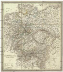
Deutschland
1 : 2350000 Evropa střední Weiland, Karl Ferdinand Geographisches Institut
Deutschland.
1 : 2300000 Weiland, C. F. (Carl Ferdinand), d. 1847
Deutschland
1 : 2350000 Evropa střední Weiland, Karl Ferdinand Geographisches Institut

Germany, Switzerland, N. Italy.
1 : 5300000 Mitchell, Samuel Augustus
Deutschland.
1 : 3400000 Radefeld, Carl Christian Franz, 1788-1874
Der Deutsche Bundesstaat in 23 Republiken nach Struve's Grundrechten des deutschen Volks
1 : 4500000 Lithogr. von F. Bruder in Basel Basel : [s.n.]
Mitteleuropa 1949
Mitteleuropa Kunz, Andreas ; Treiling, Thomas
Nationalitäts-Karte Deutschland
1 : 3800000 Mollova mapová sbírka Kiepert, Heinrich
Mitteleuropa 1922
Mitteleuropa Kunz, Andreas ; Moeschl, Joachim Robert
Mitteleuropa 1956
Mitteleuropa Kunz, Andreas ; Treiling, Thomas
Mitteleuropa 1945
Mitteleuropa Kunz, Andreas ; Treiling, Thomas
Deutschland.
1 : 2400000 Ziegler, J. M.
Deutschland's Eisenbahnen und Strassen-Netz mit seinen Anschlüssen im Ausland nebst Angabe der wichtigsten Flussdampfschiff-Stationen und Häfen für Seedampfer
1 : 2080000 Evropa střední Gräf, Adolf Hensgen, C. Geographisches Institut
Deutschland nach seinen oro-hydrographischen Verhältnissen
1 : 2570000 Evropa střední Gräf, Adolf Eyb, O. B. Geographisches Institut
Deutschland.
1 : 3400000 Flemming, Carl
Deutsches Reich nebts Deutsch-Österreich und Schweiz
1 : 1825000 Evropa střední Handtke, Friedrich Carl Flemming
Deutschland ́s Eisenbahnen und Strassen - Netz

Mitteleuropa 1993
Mitteleuropa Kunz, Andreas ; Treiling, Thomas
Mitteleuropa 1989
Mitteleuropa Kunz, Andreas ; Treiling, Thomas
Germaniae Veteris, typus. [Karte], in: Novus atlas absolutissimus, Bd. 2, S. 8.
1 Karte aus Atlas Janssonius Offizin
Mitteleuropa 1990
Mitteleuropa Kunz, Andreas ; Treiling, Thomas
Mitteleuropa 1820
Mitteleuropa Kunz, Andreas ; Moeschl, Joachim Robert
Karte von Deutschland
Grosser Hand-Atlas über alle Theile der Erde in 170 Karten Meyer, J. Verlag des Bibliographischen Instituts
Confederation Germanique.
1 : 4000000 Malte-Brun, Conrad, 1775-1826
Karte der Bäder und Kurorte Deutschlands, Oesterreich-Ungarns und der Schweiz
1 : 2000000 Německo Liebenow, W. Bäder-Almanach
Karte der Bäder und Kurorte Deutschlands, Oesterreich-Ungarns und der Schweiz
1 : 2000000 Německo Liebenow, W. Bäder-Almanach