Maps of Metropolitan France

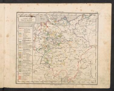
Deutschland
E. von Sydow's Schul-Atlas in sechs und dreissig Karten Sydow, Emil von bei Justus Perthes
Deutschland, Niederlande, Belgien und Schweiz
Schul-Atlas über alle Theile der Erde nach dem neuesten Zustande, und über das Weltgebäude Stieler, Adolf Justus Perthes
2. Pyrenäenfriede 1659
1 : 30000000 Mitteleuropa Pyrenäenfriede
Mitteleuropa, Geologische Übersicht
1 : 3500000 Scobel, Albert
France, Switzerland, Germany.
Goodrich, S.G.
Kriegszusammenhänge I (1618 - 1660)
1 : 12000000 Ostmitteleuropa Dreißigjähriger Krieg, Nordischer Krieg <1655-1660>
Deutschland
Allgemeiner Atlas [Walch, Johannes] im Verlag bei Johannes Walch
Special-karte von Deutschland: nebst einem Theile der angrenzenden Länder mit Gesonderer Berücksichtigung der Gebirge und Gewässer
Fried, Franz
Eisenbahn-Übersichtskarte von Mittel-Europa
Evropa R. v. Waldheim
Eisenbahn-Übersichtskarte von Mittel-Europa
Evropa R. v. Waldheim
Eisenbahn-Übersichtskarte von Mittel-Europa
Evropa
Eisenbahn-Übersichtskarte von Mittel-Europa
Evropa R. v. Waldheim
Schul-Atlas für die alte Erdbeschreibung : zur allgemeinen Schul-encyclopädie gehörig
J. H. Campe Zusammensetzung und Zeichnung von [...] Dufour, unter Leitung von Heusinger ; gestochen von Frentzel. Braunschweig : Schulbuchhandlung
Eisenbahn und Telegraphen-Karte von Europa
Evropa Kastner, Leopold Hacker, Ant. Mechitharisten-Buchdruckerei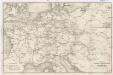
Eisenbahn und Telegraphen-Karte von Europa
Evropa Kastner, Leopold Hacker, A.
R.A. Schulz's neue praktische Reise-Karte mit Angabe der Distanzen
Evropa střední Schulz, R. A. Biller, Dominik Artaria & Co.
R.A. Schulz's neue praktische Reise-Karte mit Angabe der Distanzen
Evropa střední Schulz, R. A. Artaria & Co.
Reise-Karte von Mittel-Europa : mit Angabe der Bahnstationen und Postverbindungen / nach den neuesten Quellen entw. u. gezeichnet. von M. Hermann
1 : 2800000 Annotatie: Bijlage bij: J.C. König und Erhardt's Tages-Notizbuch Hermann, M. [S.l. : s.n.] / (Glogau : Flemming)
Germany.
from A system of geography, or, A new & accurate description of the earth in all its empires, kingdoms and states : illustrated with history and topography, and maps of every country : fairly engraven on copper, according to the latest discoveries and corrections / by Herman Moll.
Rozšíření nejstarší keramiky české v Evropě
Evropa
Deutsches Reich. Niederlande, Belgien & Schweiz
Adolf Stieler's Handatlas über alle Theile der Erde und über das Weltgebäude Stieler, Adolf Justus Perthes
Mitteleuropa
1 : 3500000 Evropa střední Köcher
Prussia, and the German States.
from New general atlas.
Karte der Eisenbahnen Mittel - Europa ́s ...

R.A. Schulz's neue praktische Reise-Karte mit Angabe der Distanzen
Anglie Schulz, R. A. Biller, Dominik Artaria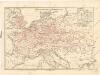
Eisenbahnkarte von Mitteleuropa
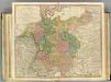
German Empire.
1 : 2150000 Faden, William, 1750?-1836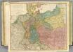
German Empire.
1 : 2150000 Faden, William, 1750?-1836
Mitteleuropa
1 : 8000000 Evropa střední Kocen, Blaž Eduard Hölzel