Cataloged map
2. Pyrenäenfriede 1659


Full title:2. Pyrenäenfriede 1659
Depicted:1659
Pubdate:1918
Physical Size:20 x 30 cm
Map scale:1:30 000 000
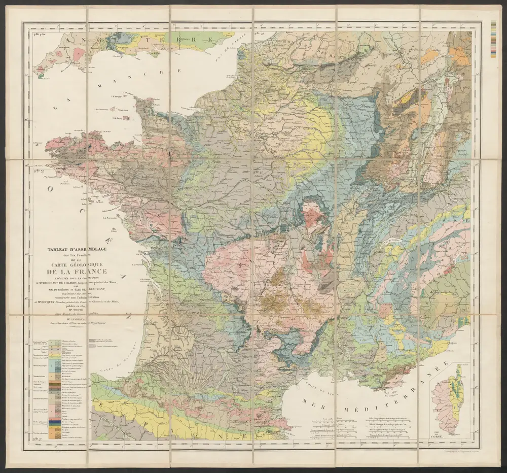
Tableau d'Assemblage des Six Feuilles de la Carte Géologique de la France
1841
Dufrénoy, Ours-Pierre-Armand Petit- ; Elie de Beaumont, Jean Baptiste Armand Louis Léonce ; Brochant de Villiers, André Jean François Marie
1:2m
Les routes exactes des postes du royaume de France
1780
Seutter; Lotter
Les routes exactes des postes du royaume de France
1760
Seutter
Les routes exactes des postes du royaume de France
1780
Seutter; Lotter
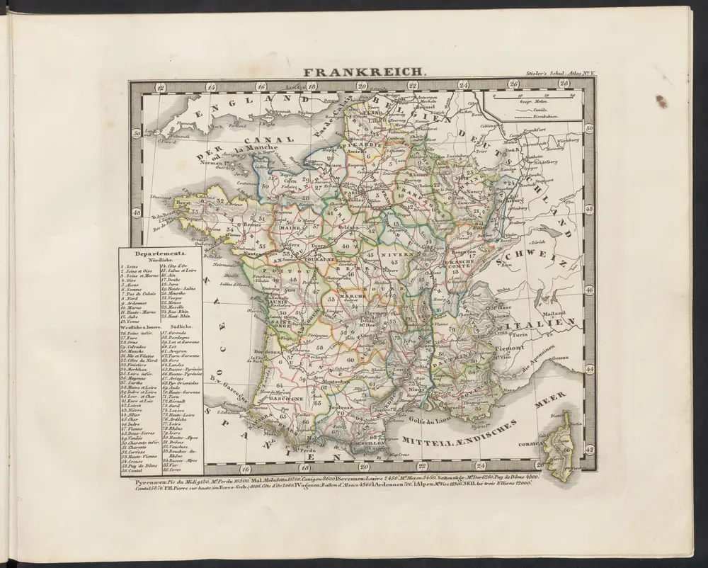
Frankreich
1851
Stieler, Adolf
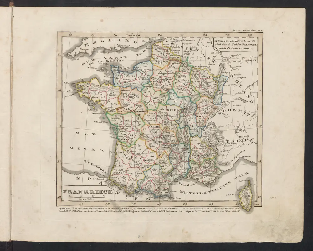
Frankreich
1842
Stieler, Adolf
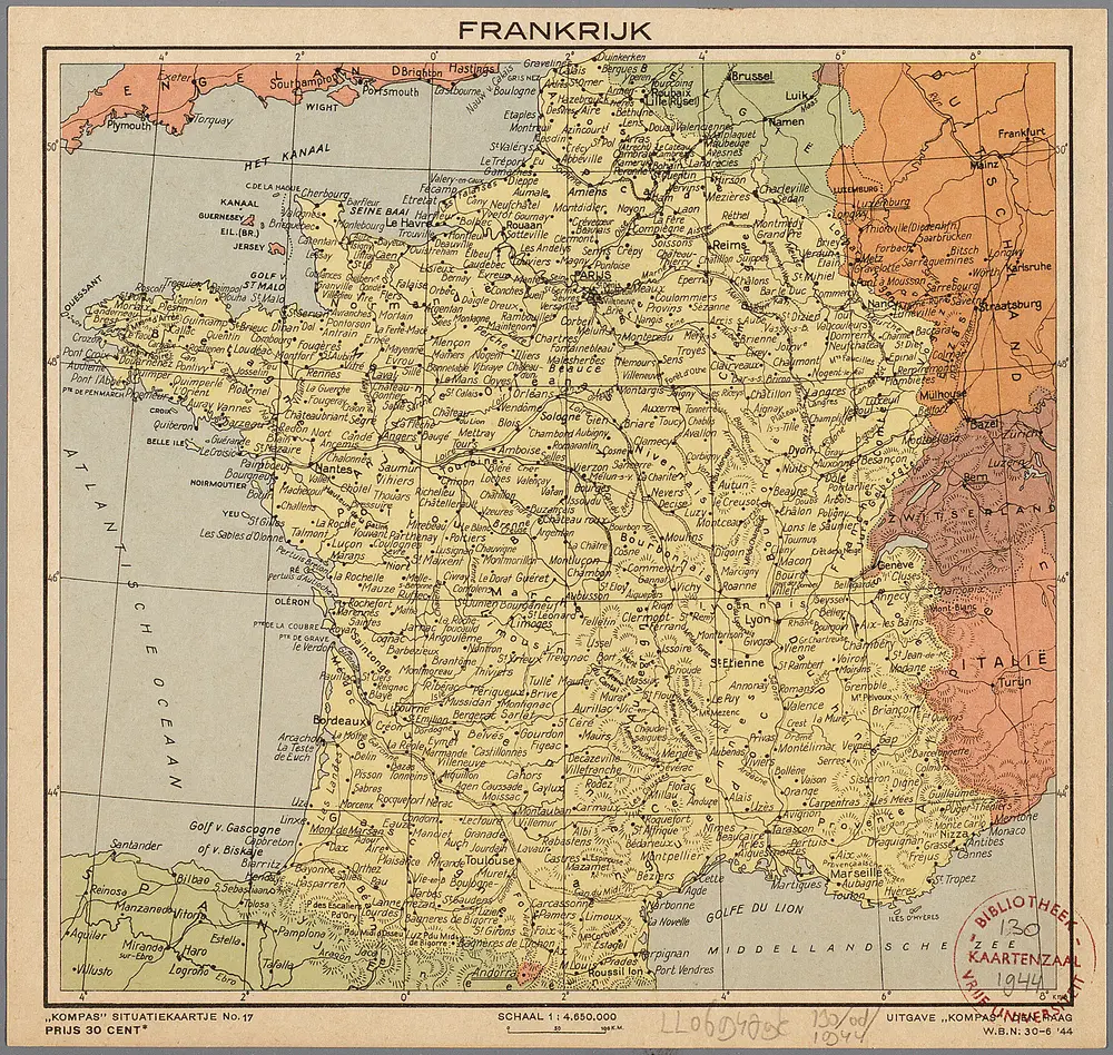
Frankrijk
1944
Den Haag : Kompas
1:5m
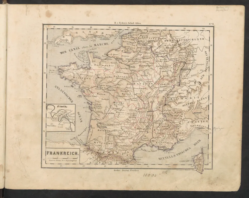
Frankreich
1849
Sydow, Emil von
Tres nouvelle carte du royaume de France
1764
Cassini de Thury; Rizzi-Zannoni; Dorn
Regni Galliae seu Franciae et Navarrae tabula geographica
1741
L'Isle