Maps of Czech Republic

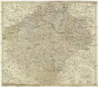
Karte von dem Koenigreich Boeheim
1 : 530000 Čechy (Česko) Walch, Johann Joh. Walch
Karte von dem Koenigreich Boeheim
1 : 530000 Čechy (Česko) Walch, Johann Joh. Walch
Stellung der Blaetter
Česko
Frekventations-Karte der kön. böhm. Landesgebäranstalt
Čechy (Česko)
Mapa Království českého
Čechy (Česko) Křesina, Ant. Pukl, D.
Post= Charte vom Königreiche Böheim
mapa VKOL Kreibich, František Jakub Jindřich Herausgegeben von C.E. Rainold
Mapka lázní, léčebných míst a letních sídel v království Českém [sic]
Česko
Isochronická mapa Čech s úvodem o isochronii vůbec

Karte von Böhmen
1 : 518400 Česko
Králowstwí České

Školní závěsná mapa Království českého
1 : 288000 Česko Křížek, Václav v komisi Karla Janského
Království české
Česko Schlieben Ausfeld, Johann Carl sklad a tisk F. Líbiše
Topographisch-statistische Post und Strassenkarte des Königreiches Boehmen nach der neuen politischen Eintheilung
1 : 400000 Praha (Česko) Anděl, Bedřich bei Marco Berra
Příruční mapa Království českého
1 : 600000 Česko Wagner, Jan Eduard F. Kytka
Králowstwj české
Česko Wondra, Jos. Havlík, H.
Geologická mapa Království českého
1 : 1000000 Čechy (Česko) Wagner, Jan Eduard Fr. A. Urbánek
Mappa geographica totius Regni Bohemiae in 12. circulos divisae, annexis comitatu Glacensi et districtu Egerano nec non aliis principatib. finitimis
1 : 730000 Kladsko-oblast (Polsko) Lotter, Tobias Conrad T. C. Lotter
Karte von Böhmen
Čechy (Česko) Habel, Johann K.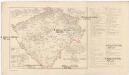
Mapa sídel velkoprůmyslu továrního v Čechách
Čechy (Česko) Wagner, Jan Eduard Otto, Jan J. Otto
Mapa sídel velkoprůmyslu zemědělského a příbuzného v Čechách
Praha (Česko) Wagner, Jan Eduard Otto, Jan J. Otto
Kreis-, Gerichts-, Völke-, Telegrafe-, Eisenbahn- und Post- Karte des Königreiches Boehmen
1 : 860000 Čechy (Česko) Franz Raffelsperger
Isochronická mapa Čech
1 : 750000 Čechy (Česko) Nový, Václav
Isochronenkarte Boehmens
1 : 750000 Čechy (Česko) Nový, Václav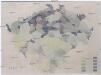
[Mapa hustoty železniční sítě v Čechách]
1 : 1000000 Čechy (Česko) Novák, Fr.
Místopisná mapa Království českého
1 : 560000 Česko Brunclík, Josef Jos. L. Švíkal
Místopisná mapa Království českého
1 : 560000 Česko Brunclík, Josef Jos. L. Švíkal
Přehledná mapa pokračovacích škol průmyslových, kupeckých a j. v Království českém
Česko c. a k. dvorní litografie A. Haase
Neueste General Post

Karte der confessionellen Verhältnisse des Königreiches Böhmen
1 : 600000 Čechy (Česko) Hickmann, Anton L. A.L. Hickmann
Neue und vollkommene Karte vom Köngreich Böhmen
Česko Unschuld, Alois Born, Joseph von