Maps of Czech Republic

Školní závěsná mapa Království českého
1 : 288000 Česko Křížek, Václav v komisi Karla Janského
Království české
Česko Schlieben Ausfeld, Johann Carl sklad a tisk F. Líbiše
Topographisch-statistische Post und Strassenkarte des Königreiches Boehmen nach der neuen politischen Eintheilung
1 : 400000 Praha (Česko) Anděl, Bedřich bei Marco Berra
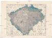
Království české
1 : 570000 Česko Wagner, Jan Eduard Jan Ed. Wagner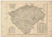
Království české
1 : 570000 Česko Wagner, Jan Eduard Jan Ed. Wagner
Království české
1 : 570000 Česko Wagner, Jan Eduard Jan Ed. Wagner
Království české
1 : 570000 Česko Wagner, Jan Eduard Jan Ed. Wagner
Karte des Königreich's Boehmen
1 : 415000 Česko Friedrich Kretzschmar
Isochronická mapa Čech
1 : 750000 Čechy (Česko) Nový, Václav
Isochronenkarte Boehmens
1 : 750000 Čechy (Česko) Nový, Václav
General-Karte des Königreiches Böhmen
1 : 378000 Čechy (Česko) Kořistka, Karel František Edvard Sommer, Adolf Eduard Hölzel's Verlag
Čechy
1 : 500000 Čechy (Česko) Havránek, J. E. Fastr
Neueste General Post
Dešťopisná mapa Čech
Čechy (Česko) Studnička, František Josef Langweil, Antonín
Dešťopisná mapa Čech
Čechy (Česko) Studnička, František Josef
Vodní mapa Čech se sití [sic] železniční
1 : 374000 Česko Mayr, Jos. Spolek českých lesníků
Statistisch topographische Finanz-Karte des Königreiches Boehmen
1 : 421500 Čechy (Česko) Herz, Johann Kübeck zu Kübau, Carl Friedrich bei Gottlieb Haase Sohne
Geologische Uebersichtskarte von Böhmen
1 : 720000 Čechy (Česko) Katzer, Friedrich Isak Taussig
Mapa poštovních spojů v Čechách
1 : 400000 Pardubice (Česko : oblast) Ministerstvo pošt a telegrafů
Mapa poštovních spojů v Čechách
1 : 400000 Česko Pachman, Josef Ministerstvo pošt a telegrafů
Přehledná mapa železniční Království českého
1 : 600000 Česko Zemský výbor
Přehledná mapa železniční Království českého
Česko Zemský výbor
Das Königreich Böhmen
1 : 725000 Česko K. André
Das Königreich Böhmen
1 : 725000 Česko K. André
Čechy
1 : 1300000 Praha-oblast (Česko) Salač, Klement B. Kočí
Karte von Böhmen
1 : 518400 Česko
Příruční mapa Království českého
1 : 600000 Česko Wagner, Jan Eduard F. Kytka
Králowstwj české
Česko Wondra, Jos. Havlík, H.
[Soudní okresy Čech]
1 : 500000 Česko
[Soudní okresy Čech]
1 : 1000000 Česko


