Maps of Czech Republic

[Soudní okresy Čech]
1 : 500000 Česko
[Soudní okresy Čech]
1 : 1000000 Česko
[Soudní okresy Čech]
1 : 750000 Česko
Neueste General Post

[Čechy]
1 : 600000 Čechy (Česko)
Post-Charte vom Königreiche Böheim
1 : 925000 Česko Kreibich, František Jakub Jindřich Rainold, Karl Eduard C.E. Rainold
Post-Charte vom Königreiche Böheim
1 : 925000 Česko Kreibich, František Jakub Jindřich Rainold, Karl Eduard C.E. Rainold
Post-Charte vom Königreiche Böheim
1 : 925000 Česko Kreibich, František Jakub Jindřich Rainold, Karl Eduard C.E. Rainold
Post-Charte vom Königreiche Böheim
1 : 925000 Česko Kreibich, František Jakub Jindřich Rainold, Karl Eduard C.E. Rainold
Post-Charte vom Königreiche Böheim
1 : 925000 Česko Kreibich, František Jakub Jindřich Rainold, Karl Eduard C.E. Rainold
Rozdělení okresů školních v Království českém

Karte der confessionellen Verhältnisse des Königreiches Böhmen
1 : 600000 Čechy (Česko) Hickmann, Anton L. A.L. Hickmann
Karte vom Königreiche Böhmen in Cameralämtlicher Hinsicht
Praha (Česko) Seidler, Karl Friedrich
Čechy
Česko Gräf, C. Langhans, J.
Königreich Böhmen
Česko Tachauer, Ludwig Langhans, J.
Höhen-Karte, oder, Vergleichende Tafel der barometrischgemessenen Berg- und Städte-Höhen Boehmens
Česko Dlask, Vavřinec Vojtěch Langweil, Antonín Schönfeldische Steindruckerey
Isochronická mapa Čech
1 : 750000 Čechy (Česko) Nový, Václav
Isochronenkarte Boehmens
1 : 750000 Čechy (Česko) Nový, Václav
General-Karte des Königreiches Böhmen
1 : 378000 Čechy (Česko) Kořistka, Karel František Edvard Sommer, Adolf Eduard Hölzel's Verlag
Sněhová pokrývka v Čechách v zimě 1906-1907
Čechy (Česko) Augustin, František Lhota, J. nákladem České společnosti zeměvědné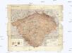
Hydrographische Übersichtskarte des Elbe-Gebietes und des in Böhmen gelegenen Oder-Gebietes
1 : 750000 Labe (Česko a Německo : řeka : povodí) k.k. hydrographisches Central-Bureau
Hydrographische Übersichtskarte des Elbe-Gebietes und des in Böhmen gelegenen Oder-Gebietes
1 : 750000 Labe-povodí (Česko a Německo) k.k. hydrographisches Central-Bureau
Přehledná geologická mapa Království českého
Čechy (Česko) Počta, Filip Lhota, J. nákladem J. Otty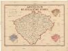
Sanitäts-Carte des Königreiches Böhmen
1 : 606000 Čechy (Česko) Antony, Karl Karl Antony
Entwurf einer statistischen Karte der Maulbeerbaumpflanzungen in Böhmen nach Daten der Bezirksvertrettungen
Čechy (Česko) Patzak, Julius Čeněk
Karte der Wahlkreiseinteilung in Böhmen.
Čechy (Česko) Urban, Karl Lhota, J.
Böhmen
Čechy (Česko)
Böhmen
Čechy (Česko)
Karte des Koenigreichs Boehmen
1 : 400000 Čechy (Česko) Loth, Johann Anděl, Bedřich Verlag von Friedrich Kretzschmar
![[Soudní okresy Čech]](https://images-2.georeferencer.com/images/iiif/063934880854/full/,300/0/native.jpg)

