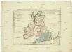
Maps of British Isles
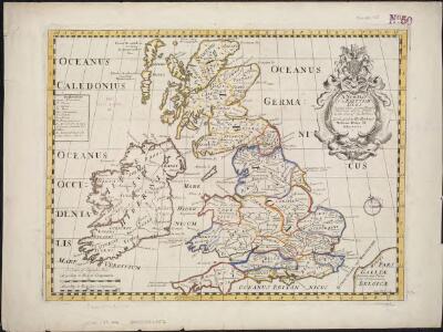
A new map of the Brittish Isles shewing their antient people, cities, and towns of note, in the time of the Romans
1 : 2846000
Britannicae Insulae in quibus Albion seu Britannia Major, et Ivernia seu Britannia Minor ...
1 : 2300000
Magnae Britanniae et Hiberniae Tabula
1 : 2300000
Die Britischen Inseln 1066 bis 1485.
1 : 3100000 Spruner von Merz, Karl
Atlas für Industrie- und Handelsgeographie: Für commercielle und technische Lehranstalten, für Kaufleute und Industrielle

Britania et Hibernia
1 : 3000000 Irsko, ostrov Spruner, Karl von Justus Perthes
Die Britischen Inseln seit 1485.
1 : 3000000 Spruner von Merz, Karl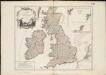
Les Isles Britanniques, qui comprennent les Royaumes d'Angleterre, d'Ecosse et d'Irlande
1 : 2000000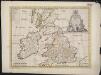
A new map of the Brittish Isles shewing their present genl. divisions, cities, and such other towns, or places, as answer to the towns of note in the time of the Romans
1 : 2851200
Nieuwe kaart van de eilanden van Groot Brittannien : behelzende de koningryken Engeland, Schotland en Ierland / volgens de laatste waarnemingen in het ligt gebragt ; C. Sepp del. et sculps. 1743
1 : 3500000 Annotatie: Oorspr. verschenen in: Nieuwe hand-atlas ... - Amsterdam : Isaak Tirion, 1744 Sepp, C. Te Amsterdam : by Isaak Tirion
Die Britischen Inseln nach ihrer kirchlichen Eintheilung bis zur Reformation.
1 : 3000000 Spruner von Merz, Karl
La grande Bretagne ou les Royaumes d'Angleterre et d'Ecosse comme aussi le Royaume d'Irlande
1 : 2300000 Anglie Lotter, Matthäus Albrecht T. C. Lotter
ANGLIAE SCOTIAE et HIBERNIAE Regna
Anglie
La Grande Bretagne ou les royaumes d'Angleterre et d'Ecosse comme aussi le royaume d'Irlande
1 : 2300000 Anglie Lotter, Tobias Conrad Lotter, Matthäus Albrecht par Tobie Conrad Lotter
Die Britischen Inseln
E. von Sydow's Schul-Atlas in sechs und dreissig Karten Sydow, Emil von bei Justus Perthes
Regnorum Magnae Britanniae et Hiberniae mappa geographica
1 : 2500000 Irsko Mayer, Tobias Homan[n]ianis Heredibus
REGNORVM MAGNAE BRITANNIAE ET HIBERNIAE MAPPA GEOGRAPHICA
1 : 2500000 Flandry Mayer, Tobias edentib[us] Homan[n]ianis Heredibus
Britannia prout divisa fuit temporibus Anglo-Saxonum praesertim durante illorum Heptarchia. [Karte], in: Le théâtre du monde, ou, Nouvel atlas contenant les chartes et descriptions de tous les païs de la terre, Bd. 4, S. 81.
1 Karte aus Atlas Blaeu, Willem Janszoon und Blaeu, Joan Blaeu, Willem Janszoon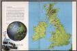
The British Isles
1 : 3000000 Debenham, Frank
MAGNAE BRITANNIAE TABULA
1 : 3170000 Anglie Visscher, Nicolaes Jansz. per Nicolaum Visscher
British Isles.
1 : 2500000 Andree, Richard; Times (London, England)
Die Brittischen Inseln
Schul-Atlas über alle Theile der Erde nach dem neuesten Zustande, und über das Weltgebäude Stieler, Adolf bei Justus Perthes
Grossbritannien und Ireland
Allgemeine Postkarte von Gross Britanien und Ireland zur Uebersicht
Irsko Stenger, Johann im von Reillyschen Landkarten und Kunstwerke Verschleiss Komptoir
Iles Britanniques.
1 : 2500000 Lapie, M. (Pierre), 1779-1850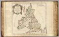
Britannicae Insulae.
1 : 2300000 Sanson, Nicolas, 1600-1667
Les Isles Britanniques


[Grossbritannien; England, Scotland und Ireland]
Geographischer Atlas über alle Theile der Erde Ziegler, Jakob Melchior Verlag von Joh. Wurster um Comp.