Maps of British Isles

Die Britischen Inseln nach ihrer kirchlichen Eintheilung bis zur Reformation.
1 : 3000000 Spruner von Merz, Karl
Die Britischen Inseln 1066 bis 1485.
1 : 3100000 Spruner von Merz, Karl
The British Isles
1 : 3000000 Debenham, Frank
British Isles.
1 : 2500000 Andree, Richard; Times (London, England)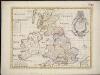
A new map of the Brittish Isles shewing their antient people, cities, and towns of note, in the time of the Romans
1 : 2846000
Britische Inseln
Volksschul-Atlas über alle Teile der Erde Lange, Henry Druck und Verlag von Georg Westermann
Großbritannien und Irland
1 : 1000000 Irsko Velhagen & Klasing
Grossbritanien.
1 : 3900000 Haller von Hallerstein, Friedrich; Reichard, C. G.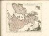

Britania et Hibernia
1 : 3000000 Irsko, ostrov Spruner, Karl von Justus Perthes
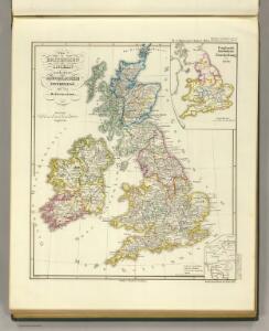
Die Britischen Inseln seit 1485.
1 : 3000000 Spruner von Merz, Karl
Soubor němých map pro gymnasia a odborné školy

British Islands.
1 : 4000000 Schonberg & Co.
Karte des Brittischen Reichs
1 : 2700000 Irsko Brué, Adrien Hubert bey Artaria et Comp.
Welká Britanie a Iry
1 : 3400000 Irsko Merklas, Václav W. Merklas
[Grossbritannien; England, Scotland und Ireland]
Geographischer Atlas über alle Theile der Erde Ziegler, Jakob Melchior Verlag von Dietrich Reimer
Welká Britanie a Iry

Atlas für Handel und Industrie: Für Kaufleute, Fabrikante u. Gewerbetreibende, Handlungs- u. Gewerbe-Schulen

Britischen Inseln.
1 : 1800000 Kiepert, Heinrich, 1818-1899
British Islands.
1 : 5500000 Fitch, George W.
Gt. Britain, Ireland.
1 : 4800000 Mitchell, Samuel Augustus
Iles Britanniques.
1 : 2500000 Andriveau-Goujon, J.
British Isles.
1 : 5000000 Adams, Daniel
Welká Britanie a Iry

[Grossbritannien; England, Scotland und Ireland]
Geographischer Atlas über alle Theile der Erde Ziegler, Jakob Melchior Verlag von Joh. Wurster um Comp.
Isles Britanniques.
1 : 2600000 Jouvet et Cie.
Bretagne apres l'invasion des Saxons, 500 ans apres Jesus Christ.
1 : 4500000 Houze, Antoine Philippe
Die Britischen Inseln
E. von Sydow's Schul-Atlas in sechs und dreissig Karten Sydow, Emil von bei Justus Perthes
Magnae Britanniae et Hiberniae Tabula
1 : 2300000