Maps of British Isles

Die Britischen Inseln seit 1485.
1 : 3000000 Spruner von Merz, Karl
Die Britischen Inseln 1066 bis 1485.
1 : 3100000 Spruner von Merz, Karl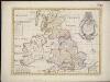
A new map of the Brittish Isles shewing their antient people, cities, and towns of note, in the time of the Romans
1 : 2846000
Die Britischen Inseln nach ihrer kirchlichen Eintheilung bis zur Reformation.
1 : 3000000 Spruner von Merz, Karl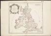
Britannicae Insulae in quibus Albion seu Britannia Major, et Ivernia seu Britannia Minor ...
1 : 2300000
Magnae Britanniae et Hiberniae Tabula
1 : 2300000
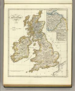
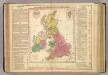
Großbritannien und Irland
1 : 1000000 Irsko Velhagen & Klasing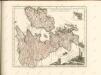

Grossbritannien, Ireland.
1 : 3800000 Flemming, Carl
British Islands.
1 : 4000000 Schonberg & Co.
Welká Britanie a Iry
1 : 3400000 Irsko Merklas, Václav W. Merklas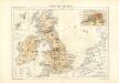
Atlas für Industrie- und Handelsgeographie: Für commercielle und technische Lehranstalten, für Kaufleute und Industrielle
British Empire.
1 : 3200000 Lavoisne, M.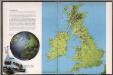
The British Isles
1 : 3000000 Debenham, Frank
Regno Unito della Gran Brettagna e dell'Irlanda.
1 : 2500000 Picquet, C.
Britania et Hibernia
1 : 3000000 Irsko, ostrov Spruner, Karl von Justus Perthes
British Isles.
1 : 2500000 Andree, Richard; Times (London, England)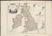
Les Isles Britanniques, qui comprennent les Royaumes d'Angleterre, d'Ecosse et d'Irlande
1 : 2000000
Nieuwe kaart van de eilanden van Groot Brittannien : behelzende de koningryken Engeland, Schotland en Ierland / volgens de laatste waarnemingen in het ligt gebragt ; C. Sepp del. et sculps. 1743
1 : 3500000 Annotatie: Oorspr. verschenen in: Nieuwe hand-atlas ... - Amsterdam : Isaak Tirion, 1744 Sepp, C. Te Amsterdam : by Isaak Tirion
Grossbritannien und Ireland

Iles Britanniques.
Andriveau-Goujon, J.
ANGLIAE SCOTIAE et HIBERNIAE Regna
Anglie
Novissima prae caeteris aliis accuratissima regnorum Angliae, Scotiae Hiberniaeq[ue] tabula
1 : 1850000 Irsko Wit, Frederick de F de Wit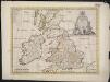
A new map of the Brittish Isles shewing their present genl. divisions, cities, and such other towns, or places, as answer to the towns of note in the time of the Romans
1 : 2851200
Angleterre, Irelande & Ecosse 1281 a 1400.
1 : 4500000 Houze, Antoine Philippe
Brittannicae Insule ex Aevi Romani Monumentis. (1826)
1 : 3900000 Tanner, Henry S.
Welká Britanie a Iry

Die Britischen Jnseln England, Schotland, Jreland
Stieler's Hand-Atlas Stieler, Adolf bei Justus Perthes
Die Britischen Inseln
E. von Sydow's Schul-Atlas in sechs und dreissig Karten Sydow, Emil von bei Justus Perthes