Maps of Algeria

Prima Affrice Tabula [Karte], in: [Clavdii Ptholomei Cosmographi ...], S. 287.
1 Karte aus Atlas Nicolaus Germanus [und Ptolemaeus, Claudius]
[Afrika, Blatt 1]
Adolf Stieler's Handatlas über alle Theile der Erde und über das Weltgebäude Stieler, Adolf Justus Perthes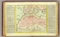
Barbarie.
1 : 11500000 Clouet, J. B. L. (Jean-Baptiste Louis), b. 1730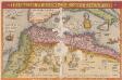
Barbarie Et Biledulgerid, Nova Descriptio. [Karte], in: Theatrum orbis terrarum, S. 317.
1 Karte aus Atlas Ortelius, Abraham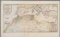
Het noordelykste deel van Afrika, behelzende Barbarie, Egypte enz. als mede de geheele Middellandsche Zee / volgens de nieuwste uitgave van den heer D'Anville
1 : 8215000 Annotatie: Oorspr. opgenomen in: Nieuwe en beknopte hand-atlas ... - Amsterdam : Isaak Tirion, [na 1769] Te Amsterdam : by Isaak Tirion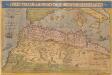
Barbariae Et Biledulgerid, Nova Descriptio. [Karte], in: Theatrum orbis terrarum, S. 122.
1 Karte aus Atlas Ortelius, Abraham
Das Nordwestliche Africa enthaltend die Staaten Fez und Marokko, Algier, Tunis und Tripoli, die Sahara, Canarischen und Azorischen Inseln oder Atlas-Land und Tiefland von Africa
1 : 6325000 entw. und gezeichnet von C. F. Weiland C. Jungmann sc. Weimar : Verlag des Geograph. Instituts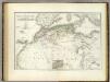
Nordwest. Africa.
1 : 6325000 Weiland, C. F. (Carl Ferdinand), d. 1847
Das Nordwestliche Africa
1 : 6300000 Weiland, Karl Ferdinand Geographisches Instituts
Evropa, 3
1 Blatt : 49 x 57 cm Homännische Erben
[Das Mittelländische Meer und Nord-Afrika, Westliches Blatt]
Hand-Atlas über alle Theile der Erde und über das Weltgebäude Stieler, Adolf Justus Perthes
[Das Mittelländische Meer und Nord-Afrika]
Handatlas über alle Theile der Erde und über das Weltgebäude Stieler, Adolf Justus Perthes
Barbarie Et Biledulgerid, Nova Descriptio. [Karte], in: Theatrum orbis terrarum, S. 418.
1 Karte aus Atlas Ortelius, Abraham Vrients, Jan Baptista
Nordwestliches Africa
Neuer Handatlas über alle Theile der Erde Kiepert, Heinrich Verlag von Dietrich Reimer
Holland West Africa Lijn

Untitled

Le Transsaharien, conférence de Mr Paul Soleillet. Carte du chemin de fer transsaharien
1 : 20850000 Société de géographie commerciale de Bordeaux Bordeaux : Société de Géographie Commerciale de Bordeaux
Das Mittelländische Meer
Stieler's Hand-Atlas Stieler, Adolf bei Justus Perthes
Aphrica Tabula I. [Karte], in: Claud. Ptolemaeus. Geographia lat. cum mappis [...], S. 283.
1 Karte aus Atlas Münster, Sebastian [und Ptolemaeus, Claudius]
Nord-Ouest de l'Afrique.
1 : 12100000 Vivien de St Martin, L.
West Africa.
1 : 15000000 Colton, G.W.
Bullettino decadico dell'osservatorio ed archivio centrale geodinamico
1 : 1200000 1886/18, Blatt 1 Archivio Centrale Geodinamico
A new map of the north part of antient Africa shewing the chiefe people, cities, towns, rivers, mountains, &c. in Mauritania, Numidia, Africa Propria, Libya Propria and Egypt
1 : 1
Mediterranean, Black Sea cables, wireless stations.
1 : 13000000 Philip, George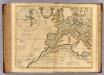
Theatrum historicum ad annum Christi quadringentesimu. Pars occidentalis.
1 : 8500000 L'Isle, Guillaume de, 1675-1726
Barbaria [Karte], in: Gerardi Mercatoris Atlas, sive, Cosmographicae meditationes de fabrica mundi et fabricati figura, S. 499.
1 Karte aus Atlas Mercator, Gerhard Montanus, Petrus
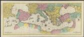
Nord de l'Afrique, Mer Mediterranee, Europe Meridionale.
1 : 9300000 Picquet, C.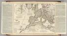
Theatrum historicum ad annum Christi quadringentesimu. Pars occidentalis.
1 : 8500000 L'Isle, Guillaume de, 1675-1726
![Prima Affrice Tabula [Karte], in: [Clavdii Ptholomei Cosmographi ...], S. 287.](https://images-2.georeferencer.com/images/iiif/428341775207/full/,300/0/native.jpg)

