Maps of Sahara
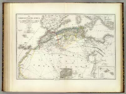
Nordwest. Africa.
1 : 6325000 Weiland, C. F. (Carl Ferdinand), d. 1847
Das Nordwestliche Africa enthaltend die Staaten Fez und Marokko, Algier, Tunis und Tripoli, die Sahara, Canarischen und Azorischen Inseln oder Atlas-Land und Tiefland von Africa
1 : 6325000 entw. und gezeichnet von C. F. Weiland C. Jungmann sc. Weimar : Verlag des Geograph. Instituts
Das Nordwestliche Africa
1 : 6300000 Weiland, Karl Ferdinand Geographisches Instituts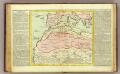
Barbarie.
1 : 11500000 Clouet, J. B. L. (Jean-Baptiste Louis), b. 1730
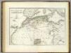
Nord-Ouest de l'Afrique.
1 : 12100000 Vivien de St Martin, L.
Prima Affrice Tabula [Karte], in: [Clavdii Ptholomei Cosmographi ...], S. 287.
1 Karte aus Atlas Nicolaus Germanus [und Ptolemaeus, Claudius]
Barbaria [Karte], in: Gerardi Mercatoris Atlas, sive, Cosmographicae meditationes de fabrica mundi et fabricati figura, S. 499.
1 Karte aus Atlas Mercator, Gerhard Montanus, Petrus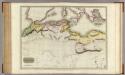
Northern Africa.
1 : 5300000 Pinkerton, John, 1758-1826
A new map of the north part of antient Africa shewing the chiefe people, cities, towns, rivers, mountains, &c. in Mauritania, Numidia, Africa Propria, Libya Propria and Egypt
1 : 1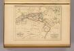
Barbarie.
1 : 12300000 Malte-Brun, Conrad, 1775-1826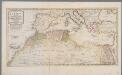
Het noordelykste deel van Afrika, behelzende Barbarie, Egypte enz. als mede de geheele Middellandsche Zee / volgens de nieuwste uitgave van den heer D'Anville
1 : 8215000 Annotatie: Oorspr. opgenomen in: Nieuwe en beknopte hand-atlas ... - Amsterdam : Isaak Tirion, [na 1769] Te Amsterdam : by Isaak Tirion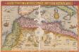
Barbarie Et Biledulgerid, Nova Descriptio. [Karte], in: Theatrum orbis terrarum, S. 317.
1 Karte aus Atlas Ortelius, Abraham
[Afrika, Blatt 1]
Adolf Stieler's Handatlas über alle Theile der Erde und über das Weltgebäude Stieler, Adolf Justus Perthes
La Barbarie.
1 : 6500000 Lapie, M. (Pierre), 1779-1850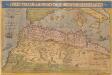
Barbariae Et Biledulgerid, Nova Descriptio. [Karte], in: Theatrum orbis terrarum, S. 122.
1 Karte aus Atlas Ortelius, Abraham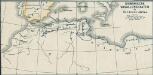
Osmanische Vasallenstaaten in Nordwest-Afrika
1 : 27000000 Osmanisches Reich, Maghreb , Protektorat
Evropa, 3
1 Blatt : 49 x 57 cm Homännische Erben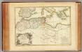
Barbarie.
1 : 8600000 Bonne, Rigobert, 1727-1794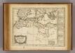
Barbarie.
1 : 17200000 Delamarche, Charles Francois; Lattre, Jean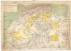
Sahara occidental et central
1 : 4000000 Afrika severozápadní Meunier, Alexandre imp. photo-métallo Millet
Le Transsaharien, conférence de Mr Paul Soleillet. Carte du chemin de fer transsaharien
1 : 20850000 Société de géographie commerciale de Bordeaux Bordeaux : Société de Géographie Commerciale de Bordeaux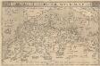
Barbarie Et Biledulgerid, Nova Descriptio. [Karte], in: Theatrum orbis terrarum, S. 418.
1 Karte aus Atlas Ortelius, Abraham Vrients, Jan Baptista
CHARTE von NORD-AFRICA
1 : 10090000 Afrika severní
Charte von Nord-Africa
1 : 10090000 Afrika severní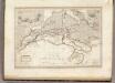
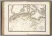
Afrique Septentrionale.
1 : 8000000 Montemont, A.
West Africa.
1 : 15000000 Colton, G.W.
Afrique Septentrionale, Malte, Acores, Madere, Canaries.
1 : 7500000 Garnier, F. A., 1803-1863
BARBARIA.
[Amsterdam : Joan Blaeu]