Maps of Sahara
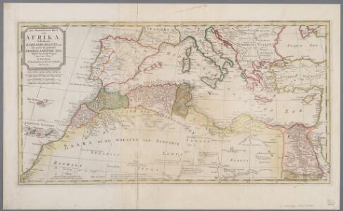
Het noordelykste deel van Afrika, behelzende Barbarie, Egypte enz. als mede de geheele Middellandsche Zee / volgens de nieuwste uitgave van den heer D'Anville
1 : 8215000 Annotatie: Oorspr. opgenomen in: Nieuwe en beknopte hand-atlas ... - Amsterdam : Isaak Tirion, [na 1769] Te Amsterdam : by Isaak Tirion
Das Reich Kalifen in seiner grossten Ausdehnung - West.
1 : 15200000 Spruner von Merz, Karl
Mediterranean, Black Sea cables, wireless stations.
1 : 13000000 Philip, George
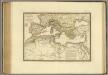
Nord de l'Afrique, Mer Mediterranee, Europe Meridionale.
1 : 9300000 Picquet, C.
Das Mittellandische Meer Und Nord-Afrika.
1 : 7500000 Petermann, A.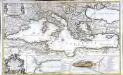
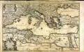
La mer Mediterranée
1 Karte auf 2 Blättern : Kupferdruck ; 53 x 87 cm Sanson; Denis; Basset; Basset chès Basset rue St. Jacques au coin de celle des Mathurins à l'Image S.e Genevieve
Barbaria [Karte], in: Gerardi Mercatoris Atlas, sive, Cosmographicae meditationes de fabrica mundi et fabricati figura, S. 499.
1 Karte aus Atlas Mercator, Gerhard Montanus, Petrus
La mer Mediterranée
1 Karte auf 2 Blatt : Kupferdruck ; 53 x 86 cm Sanson; Jaillot chez H. Iaillot joignant les grands Augustins aux 2 Globes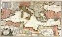
La mer Mediterranée
1 Karte auf 2 Blatt : Kupferdruck ; 47 x 85 cm Valck par G. Valck sur le Dam
[Hierographie, oder topographisch-synchronistische Darstellung der Geschichte der christlichen Kirche] : III. Origines - Nicaea
1 : 8400000 W.A. Möller Lith. bey Arnz & Co. in Düsseldorf Elberfeld : Büschler
[Hierographie, oder topographisch-synchronistische Darstellung der Geschichte der christlichen Kirche] : I. Zeiten der Apostel
1 : 8400000 W.A. Möller Lith. bey Arnz & Co. in Düsseldorf Elberfeld : Büschler
Prima Affrice Tabula [Karte], in: [Clavdii Ptholomei Cosmographi ...], S. 287.
1 Karte aus Atlas Nicolaus Germanus [und Ptolemaeus, Claudius]
Empire Romain.
Andriveau-Goujon, J.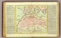
Barbarie.
1 : 11500000 Clouet, J. B. L. (Jean-Baptiste Louis), b. 1730
[Hierographie, oder topographisch-synchronistische Darstellung der Geschichte der christlichen Kirche] : IV. Von Constantin bis auf Gregor d. G. J. 325-604
1 : 8400000 W.A. Möller Lith. bey Arnz & Co. in Düsseldorf Elberfeld : Büschler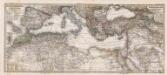
Composite: Mittellandische Meer, Nord-Afrika.
1 : 7500000 Petermann, A.
[Afrika, Blatt 1]
Adolf Stieler's Handatlas über alle Theile der Erde und über das Weltgebäude Stieler, Adolf Justus Perthes
Imperium Romanum tempore Constantini Magni

[Hierographie, oder topographisch-synchronistische Darstellung der Geschichte der christlichen Kirche] : V. Von Constantin bis auf Gregor d. G. J. 325-604
1 : 8400000 W.A. Möller Lith. bey Arnz & Co. in Düsseldorf Elberfeld : Büschler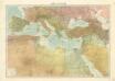
Středomoří
Nord de l'Afrique, Mer Mediterranee, Europe Meridionale.
1 : 9300000 Brue, Adrien Hubert, 1786-1832
Imperium Romanum Antiquum
Römisches Reich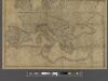
A new map of Europe exhibiting its natural and political divisions drawn from the most recent materials
From Whole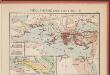
L'Hellénisme dans l'Antiquité [I]
Makedonien Hellenismus Altertum Kümmerly & Frey
[Hierographie, oder topographisch-synchronistische Darstellung der Geschichte der christlichen Kirche] : II. Von Paulus bis Origines
1 : 8400000 W.A. Möller Lith. bey Arnz & Co. in Düsseldorf Elberfeld : Büschler
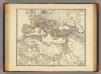
Carte approximative de la marche simultanée des Alains, des Suèves et des Vandales, en l’an 406 et suivants
Europa Alanen Vandalen Sweben
Marche des Visigoths à travers le sud de l’Europe
Südeuropa Westgoten Völkerwanderungszeit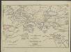
[Hierographie, oder topographisch-synchronistische Darstellung der Geschichte der christlichen Kirche] : VII. Von Gregor d. Gr. bis auf Carl d. G. J. 604-800
1 : 8400000 W.A. Möller Lith. bey Arnz & Co. in Düsseldorf Elberfeld : Büschler