Maps of Bavaria

Raetiae veteris exterae et hodiernae una cum regionibus ei guondam [i.e. quondam] adnumeratis & finitimarum regionum limitibus tabula generalis
1 : 1100000 1 Karte Matth. Hirtzg. ; Leo. Scherer [Joh. Rodolff Wolffen], [Zürich]
German Empire 3.
1 : 1774080 Letts, Son & Co.
Germany. Deutschland III.
1 : 1760000 Society for the Diffusion of Useful Knowledge (Great Britain)
Germany (Deutschland)
1 : 1750000 Bavorsko (Německo) Baldwin & Cradock
Karte von Deutschland in IV Blättern
1 : 825000 Südwest-Blatt Sotzmann, Daniel Friedrich im Verlage der A. G. Schneider und Weigels
Jiho-západní Německo a Šwejcary
1 : 3300000 Německo jihozápadní Merklas, Václav
[Südwestliches Deutschland und Schweiz]
Stieler's Hand-Atlas Stieler, Adolf bei Justus Perthes
Südwestliches Deutschland, enth. Bayern, Würtemberg, Baden, Hohenzollern und Schweiz
Hand-Atlas über alle Theile der Erde nach dem neuesten Zustande und über das Weltgebäude Stieler, Adolf bei Justus Perthes
Südwestliches Deutschland, enth. Bayern, Würtemberg, Baden, Hohenzollern und Schweiz
Hand-Atlas über alle Theile der Erde nach dem neuesten Zustande und über das Weltgebäude Stieler, Adolf bei Justus Perthes
Südwestliches Deutschland und Schweiz
Schul-Atlas über alle Theile der Erde nach dem neuesten Zustande, und über das Weltgebäude Stieler, Adolf bei Justus Perthes
Süd-Westliches Deutschland und die Schweiz
Handatlas über alle Theile der Erde und über das Weltgebäude Stieler, Adolf Justus Perthes
Sudwestliches Deutschland
1 : 1850000 Stieler, Adolf
Süd-Westliches Deutschland und die Schweiz
Hand-Atlas über alle Theile der Erde und über das Weltgebäude Stieler, Adolf Justus Perthes
Souabe, Baviere.
1 : 2900000 Clouet, J. B. L. (Jean-Baptiste Louis), b. 1730
Germania Austriaca completens s. r. i. circulum Austriacum ut et reliquas in Germania augustissimae domui Austr. devotas terras haereditarias
1 : 710000 Evropa střední Homann, Johann Baptist J. B. Homann
Sud-Westliches Deutschland Und Die Schweiz.
1 : 1850000 Vogel, C.
Karte von Baiern und Schwaben mit einem grossen Theil von Böhmen, Österreich, Salzburg, Steyermark, Kärnten und Krein
Bavorsko (Německo) Artaria

Maiestas Austriaca sive Circul. Archi Ducat.-Austriae :
1 : 1450000 Mollova mapová sbírka Seutter, Matthäus
Maiestas Austriaca sive Circ. Archi Ducat. Austriae
1 : 3400000 Mollova mapová sbírka Seutter, Matthäus Lotter, Tobias Conrad
Das Königreich Baiern
Allgemeiner Atlas [Walch, Johannes] im Verlag bei Johannes Walch
Germania Austriaca complectens S. R. I. Circulum Austriacum ut et reliquas in Germania Augustissimae Domui Austr. devotas Terras Haereditarias
1 : 1440000 Mollova mapová sbírka Homann, Johann Baptist Homann, Johann Baptista
Neueste Karte von Bayern, Tirol mit dem grösten Theil von Schwaben und angränzenden österreichischen Provinzen
1 : 790000 Bavorsko (Německo) Sotzmann, Daniel Friedrich Artaria
Der Oesterreichische Kreis
1 : 1380000 Evropa střední Güssefeld, Franz L. Liesganig, Joseph bey den Homannischen Erben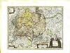
Sveviæ nova tabvla
1 Karte : Kupferdruck ; 35 x 47 cm Blaeu apud Guiljelmum Blaeuw
Karte vom Koenigreich Baiern in Kreise eingetheilt
Bavorsko (Německo) Klipstein, A. Walch, Johann bei Joh. Walch
Germaniae Avstriacae Tabula Generalis
1 : 2100000 Mollova mapová sbírka Weigel, Christoph Kauffer, Michael Weigel, Christoph I.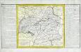
Cercle de Souabe
1 Karte : Kupferdruck ; 29 x 32 cm, Bildgrösse 31 x 55 cm Clouet Mondhare
[Atlas zur Geschichte von Bayern] : I. Rhaetia, Noricum und die angränzenden Länder
K. v. Spruner [Gotha : Perthes]
![Raetiae veteris exterae et hodiernae una cum regionibus ei guondam [i.e. quondam] adnumeratis & finitimarum regionum limitibus tabula generalis](https://images-2.georeferencer.com/images/iiif/729082490493/full/,300/0/native.jpg)

