Maps of Netherlands

Nieuwe Caerte waerinne vertoont wordt de gantsche Vaert van Amsterdam over de Watten tot de stadt Hamborch toe. [Karte, Teil 1], in: Gerardi Mercatoris et I. Hondii Newer Atlas, oder, Grosses Weltbuch, Bd. 1, S. 152.
1 Karte aus Atlas Mercator, Gerhard und Hondius, Jodocus Jansson, Jan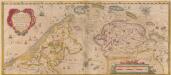
Nieuwe Caerte waerinne vertoont wordt de gantsche Vaert van Amsterdam over de Watten tot de stadt Hamborch toe. [Karte, Teil 1], in: Novus atlas absolutissimus, Bd. 2, S. 95.
1 Karte aus Atlas Janssonius Offizin

Bladwijzer van de kaarten op de schaal van 1:25 000, 1:50 000 en 1:200 000
1 : 600000 Nizozemsko Topogr. Inrichting
Descriptio Agri Frisii antiqui aliorumque trans Rhenum qui hodie sunt in dicione VII Foederatorum
1 : 700000 auctore Mensone Alting. [Amstelaedami] : [apud Henricum Wetstenium]
Holland.
1 : 1300000 Lucas, Fielding Jr.
Grande carte routiere de la Hollande
1 : 400000 Nizozemsko Cartes Taride
Netherlands.
1 : 1290000 Hughes, William
Charte des Königreichs Holland
1 : 650000 Nizozemsko Stieler, Adolf Streit, Friedrich Wilhelm
Charte des Königreichs Holland
1 : 650000 Nizozemsko Stieler, Adolf Streit, Friedrich Wilhelm
Charte des Königreichs Holland
1 : 650000 Nizozemsko Stieler, Adolf Streit, Friedrich Wilhelm
CHARTE des KÖNIGREICHS HOLLAND
1 : 640000 Nizozemsko Stieler, Adolf Streit, Friedrich Wilhelm
Charte des Königreichs Holland
1 : 650000 Nizozemsko Stieler, Adolf Streit, Friedrich Wilhelm
Charte des Königreichs Holland
1 : 650000 Nizozemsko Stieler, Adolf Streit, Friedrich Wilhelm
Seven United Provinces.
1 : 510000 Faden, William, 1750?-1836
Seven United Provinces.
1 : 950000 Playfair, Principal
Belgica foederata complectens septem provincias, ducatum Geldriae, comitatus Hollandiae et Zeelandiae dioec. traject. transisul. Groningam et Frisiam et circumjacentes provincias mappa geographica
1 : 610000 Belgie Lotter, Tobias Conrad per Tobia[m] Conr. Lotter
Belgica foederata complectens septem provincias, ducatum Geldriae, comitatus Hollandiae et Zeelandiae dioec. traject. transisul. Groningam et Frisiam et circumjacentes provincias mappa geographica
1 : 610000 Belgie Lotter, Tobias Conrad Lotter, Matthäus Albrecht per Tobia[m] Conr. Lotter
Overzichtskaart van den Topographischen atlas van het Koningrijk der Nederlanden op de schaal van 1:200.000
1 : 1000000 titelvariant: Bladwijzer van den Topographischen atlas van het Koninkrijk der Nederlanden op de schaal van 1:200.000; Topographische atlas van het Koningrijk der Nederlanden op de schaal van 1:200.000; Annotatie: Omslagtitel: Bladwijzer van den Topographischen atlas van het Koninkrijk der Nederlanden op de schaal van 1:200.000 ['s-Gravenhage : Topographische Inrichting]
Holland.
1 : 1280000 Tanner, Henry S.
Charte der Hollaendischen départemens
Nizozemsko Kipferling, Karl Joseph Krayenhoff, Cornelius Rudolphus Theodorus J. Riedl's Kunsthandung
Charte der Hollaendischen départemens
Nizozemsko Krayenhoff, Cornelius Rudolphus Theodorus Verlage des Kunst und Industrie
Karte der itzo vereinigten Niederlande
1 : 990000 Nizozemsko
Seven United Provinces.
1 : 1460000 Bowen, Frances
Holland.
1 : 520000 Thomson, John
Belgium foederatum
1 : 640000 Indonésie Seutter, Matthäus studio [Mattha]ei Seutteri
Holland.
1 : 1290000 Finley, Anthony
Nouvelle carte de la Hollande, d'apres Krayenhoff et les meilleurs cartes connues : 24 feuilles
1 : 115200 Établissement Géographique de Bruxelles, Fondé par Ph. Vander Maelen. Bruxelles : Etablissement geographique, fondé par Ph. Vander Maelen
Belgium Foederatum
1 : 620000 Mollova mapová sbírka Danckerts, Justus Danckerts, Justus
![Nieuwe Caerte waerinne vertoont wordt de gantsche Vaert van Amsterdam over de Watten tot de stadt Hamborch toe. [Karte, Teil 1], in: Gerardi Mercatoris et I. Hondii Newer Atlas, oder, Grosses Weltbuch, Bd. 1, S. 152.](https://images-2.georeferencer.com/images/iiif/433741943511/full/,300/0/native.jpg)

