Maps of Belgium
Brabantia V. Rheni Et X. Nova Tabula. [Karte], in: Claud. Ptolemaeus. Geographia lat. cum mappis [...], S. 377.
1 Karte aus Atlas Münster, Sebastian [und Ptolemaeus, Claudius]
Brabantia V. Rheni Et X. Nova Tabula. [Karte], in: Geographia universalis vetus et nova complectens Claudii Ptolemaei Alexandrini enarrationis libros VIII, S. 326.
1 Karte aus Atlas Münster, Sebastian [und Ptolemaeus, Claudius]
Bijlage 13, uit: Eindverslag over de onderzoekingen en uitkomsten van den Dienst der Rijksopsporing van Delfstoffen in Nederland, 1903-1916
Annotatie: Met lit. opg Departement van Landbouw, Nijverheid en Handel. Dienst der Rijksopsporing van Delfstoffen ['s-Gravenhage : Martinus Nijhoff]
Souhvězdí naší oblohy
Nizozemsko Studnička, Alois Stumper, Č. Alois Studnička
Köenigreich Niederland nach der letzten Grenz-Berichtigung verfasst
1 : 1200000 Nizozemsko Mollo, Tranquillo Tranquillo Mollo
Köenigreich Niederland nach der letzten Grenz-Berichtigung verfasst
1 : 1200000 Nizozemsko Tranquillo Mollo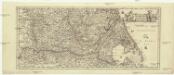
[Nizozemsko]
1 : 970000 Belgie
Karte des Rheins von Linz bis zu seinen Mündungen in die Nord und Zuyder See, nebst den Maas von Maastricht bis zu ihrer Mündung
1 : 630000 Linec (Rakousko) Streit, Friedrich Wilhelm Joseph Engelman[n]
Aachen, Brüssel, St. Quentin
1 : 750000 Brusel (Belgie : oblast) Nicklas, C. K. u. k. Militärgeographisches Institut
Aachen, Brüssel, St. Quentin
1 : 750000 Brusel (Belgie : oblast) K. k. militär-geographisches Institut
Rhein Maas und Schelde oder das Königreich der Niederland von Dinant bis Alkmaar
Stieler's Hand-Atlas Stieler, Adolf bei Justus Perthes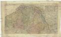
Novissima et accuratissima decem Austriacarum in Belgio provinciarum tabula
1 : 590000 Belgie Ottens, Josua Ottens, Reinier R.& I. Ottens
[Kaart], uit: Grande carte routière de la Hollande (Pays-Bas, Nederland) à l'usage des automobiles, cyclistes, touristes, etc. / P. Bineteau, del.
1 : 400000 Bineteau, P. Paris : Taride
Caerte vande Vereenichde Nederlanden
1 : 750000 Mollova mapová sbírka Visscher, Claes Janszoon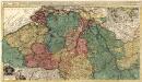
Novissima et Accuratissima decem Austriacarum in Belgio Provinciarum Tabula
1 : 600000 Mollova mapová sbírka Ottens, Joachim
Caerte vande VEREENICHDE NEDERlanden
1 : 720000 Belgie Visscher, Claes Jansz. gedruckt by Claes Ianß Visscher inde Calverstraet inde Visscher
Netherlands.
1 : 1190000 Finley, Anthony
Schetskaart van Nederland
1 : 600000 [S.l. : Topografische Dienst]
Délineation géographique, tant de l'ancien que du moderne Brabant avecq les parties y comprinses selon qu'elles estoient devant les inondations des terre vers la Hollande advenues en l'an 1421
1 : 525000 [S.l.] : [s.n.]
Les Provinces des Pays-Bas Catholiques Vulgairement Connües Sous le Nom de Flandre
1 : 800000 Mollova mapová sbírka Sanson, Nicolas Michault, René
Regionum Urbium et fluminum quae potissimum Comitatum Mürs ambiunt brevis descriptio. [Karte], in: Gerardi Mercatoris et I. Hondii Newer Atlas, oder, Grosses Weltbuch, Bd. 1, S. 212.
1 Karte aus Atlas Mercator, Gerhard und Hondius, Jodocus Jansson, Jan
58 Roermond, uit: Topographische en militaire kaart van het Koningrijk der Nederlanden / vervaardigd door de officieren van den Generale Staf ; en gegraveerd op het Topographisch Bureau, van het Ministerie van Oorlog
1 : 50000 titelvariant: TMK; Annotatie: Met bladwijzer op schaal 1:600.000. - 1915; Met Verklaring van de topographische en militaire kaart van het Koninkrijk der Nederlanden. - 1910; Bd. 1: titelblad, bladwijzer, verklaring, bladen 1 t/m 32; Bd. 2: bladen 33 t/m 62 Generale Staf, Nederland; Ministerie van Oorlog. Topographisch Bureau ['s-Gravenhage : Ministerie van Oorlog]
Regionum Urbium et fluminum quae potissimus Comitatum Mürs ambiunt brevis descriptio. [Karte], in: Gerardi Mercatoris Atlas, sive, Cosmographicae meditationes de fabrica mundi et fabricati figura, S. 352.
1 Karte aus Atlas Mercator, Gerhard Montanus, Petrus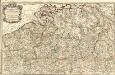
Carte Particuliere des Duchéz de Brabant et de Limbourg
1 : 317000 Mollova mapová sbírka Baillieul, Gaspard Bailleul, Gaspard
Kaart behoorende bij de statistiek der scheepvaartbeweging in Nederland in 1918
1 : 600000 Annotatie: Op- en afvoer tezamen in 1000-tallen van M3 [S.l. : Topographische Inrichting]
Netherlands.
1 : 1650000 Bowen, Frances
Koningryk der Nederlanden naar het verdrag van den 19 april 1839
1 : 630000 Lucembursko Raes, D. D. Raes
[overzicht], 1906-07, uit: Topographische kaart van het Koninkrijk der Nederlanden : in chromo-lithographie op de schaal van 1:200.000
1 : 200000 Annotatie: Voor aanwezige bladen zie overzichtsblad ['s-Gravenhage : Topographische Inrichting]
[overzicht], 1900, uit: Topographische kaart van het Koninkrijk der Nederlanden : in chromo-lithographie op de schaal van 1:200.000
1 : 200000 Annotatie: Voor aanwezige bladen zie overzichtsblad ['s-Gravenhage : Topographische Inrichting]
![Brabantia V. Rheni Et X. Nova Tabula. [Karte], in: Claud. Ptolemaeus. Geographia lat. cum mappis [...], S. 377.](https://images-2.georeferencer.com/images/iiif/835124832711/full/,300/0/native.jpg)

