Maps of Netherlands

Rhein Maas und Schelde oder das Königreich der Niederland von Dinant bis Alkmaar
Stieler's Hand-Atlas Stieler, Adolf bei Justus Perthes
Netherlands.
1 : 1190000 Finley, Anthony
Netherlands.
1 : 945000 Hall, S. (Sidney)
Belgium, Netherlands.
1 : 789237 Johnston, Alexander Keith, 1804-1871
Benelux Countries.
1 : 1100000 Rand McNally and Company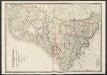
Netherlands
A new general atlas of modern geography, consisting of a complete collection of maps of the four quarters of the globe Wyld, James James Wyld
Les Provinces des Pays-Bas Catholiques Vulgairement Connües Sous le Nom de Flandre
1 : 800000 Mollova mapová sbírka Sanson, Nicolas Michault, René
Bijlage 13, uit: Eindverslag over de onderzoekingen en uitkomsten van den Dienst der Rijksopsporing van Delfstoffen in Nederland, 1903-1916
Annotatie: Met lit. opg Departement van Landbouw, Nijverheid en Handel. Dienst der Rijksopsporing van Delfstoffen ['s-Gravenhage : Martinus Nijhoff]
Holland, Belgien, Luxemburg.
1 : 1350000 Radefeld, Carl Christian Franz, 1788-1874
Souhvězdí naší oblohy
Nizozemsko Studnička, Alois Stumper, Č. Alois Studnička
Köenigreich Niederland nach der letzten Grenz-Berichtigung verfasst
1 : 1200000 Nizozemsko Mollo, Tranquillo Tranquillo Mollo
Köenigreich Niederland nach der letzten Grenz-Berichtigung verfasst
1 : 1200000 Nizozemsko Tranquillo Mollo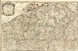
Carte Particuliere des Duchéz de Brabant et de Limbourg
1 : 317000 Mollova mapová sbírka Baillieul, Gaspard Bailleul, Gaspard
Karte des Rheins von Linz bis zu seinen Mündungen in die Nord und Zuyder See, nebst den Maas von Maastricht bis zu ihrer Mündung
1 : 630000 Linec (Rakousko) Streit, Friedrich Wilhelm Joseph Engelman[n]
[Kaart], uit: Grande carte routière de la Hollande (Pays-Bas, Nederland) à l'usage des automobiles, cyclistes, touristes, etc. / P. Bineteau, del.
1 : 400000 Bineteau, P. Paris : Taride
Aachen, Brüssel, St. Quentin
1 : 750000 Brusel (Belgie : oblast) Nicklas, C. K. u. k. Militärgeographisches Institut
Aachen, Brüssel, St. Quentin
1 : 750000 Brusel (Belgie : oblast) K. k. militär-geographisches Institut
Carte des Paysbas Catholiques
1 : 700000 Mollova mapová sbírka Delisle, Guillaume L'Isle, Guillaume de
Holland, Friesland, Groningen, Overyssel, Gelders, Utrecht and Zealand.
1 : 2471040 Carey, Mathew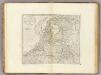
The Seven United Provinces of Holland, Groningen, Gelders, Friesland, Overyssel, Utrecht and Zealand.
1 : 2407680 Carey, Mathew
The Seven United Provinces of Holland, Groningen, Gelders, Friesland, Overyssel, Utrecht and Zealand.
1 : 2407680 Carey, Mathew
Republik der Vereinigten Niederlande Innerer Aufbau 1648
Niederlande Verwaltungsgliederung Kunz, Andreas ; Moeschl, Joachim Robert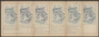
Brabantia V. Rheni Et X. Nova Tabula. [Karte], in: Claud. Ptolemaeus. Geographia lat. cum mappis [...], S. 377.
1 Karte aus Atlas Münster, Sebastian [und Ptolemaeus, Claudius]
Carte des Provinces Unies des Pays Bas
1 : 700000 Mollova mapová sbírka Delisle, Guillaume Covens, Johannes I
Niederlande.
1 : 1200000 Andree, Richard
Holland (The Netherlands)
1 : 1200000 Andree, Richard
Carte Des Provinces Unies Des Pays-Bas
1 : 690000 Mollova mapová sbírka Delisle, Guillaume L'Isle, Guillaume de
The Seven United Provinces of Holland, Groningen, Gelders, Friesland, Overyssel, Utrecht, and Zealand.
1 : 1180000 Melish, John
Délineation géographique, tant de l'ancien que du moderne Brabant avecq les parties y comprinses selon qu'elles estoient devant les inondations des terre vers la Hollande advenues en l'an 1421
1 : 525000 [S.l.] : [s.n.]


