Maps of Teurthéville-Hague
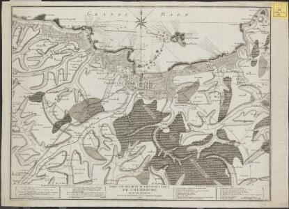
Carte topographique du port et de la Ville de Cherbourg et de ses environs
1 : 30000 levées sur les lieux par J.G.B. Ingenieur geographe, 1787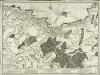
Carte topographique du port et de la ville de Cherbourg et de ses environs
1 Karte : Kupferdruck ; 49 x 71 cm s.n.
A genuine plan of Cherburg with the fortifications, as intended to be finished according to the design of Mr. De Caux
1 : 1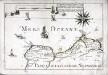
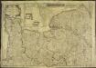
Capitaineries garde costes de Barfleur Retauville et partie de celle de Cherbourg
1 Karte : 22 x 32 cm de Fer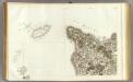
125 Cherbourg.
1 : 86400 Cassini family; Cassini, Cesar-Francois, 1714-1784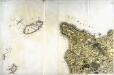
[Cherbourg]
1 Blatt : 60 x 91 cm s.n.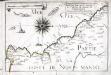
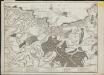
Capitaineries garde costes de Port Bail Coutenville et partie de celle de Cherbourg
1 Karte : 22 x 32 cm de Fer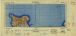
France 1:250,000, Cherbourg
Sheet 3a of the 40-sheet map series, France 1:250 000, Series GSGS 2738. Great Britain. General Staff. Geographical Section. [London] : [GSGS, War Office]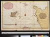
Een gedeelte van het Kanaal van Cherborgh tot t eijland Jerseij
France Gerard van Keulen
Diocese de Coutances, [feuille 2 et 4]
2 Blätter : Dezauche
Dept. De La Manche.
1 : 455000 Levasseur, Victor.
Carte générale, des isles Grenesey, Jersey, Aurigny, Chausey, &c
1 Karte : Kupferdruck ; 50 x 43 cm Beaurain chez le chevalier de Beaurain rue Git-le cœur la 1.ere porte en entrant par le quai des Augustins

Département de la Manche
1 Karte : Kupferdruck ; 60 x 40 cm au bureau de l'atlas national rue de la Harpe n.o 26, et au dépost de cet atlas rue de la Monnoie n.o 5

Département de la Manche
1 Karte : Kupferdruck ; 41 x 34 cm Capitaine s.n.
Jersey, Guernsey.
1 : 364000 Faden, William, 1750?-1836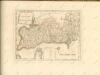

Carte reduite des isles de Jersey, Grenesey et d'Aurigny
1 Karte : Kupferdruck ; 54 x 40 cm Bellin s.n.
Carte de la province de Normandie, 1
1 Blatt : Esnauts et Rapilly
Le gouvernement general de Normandie, 1
1 Blatt : chez l'auteur Jaillot
delineation of the strata of England and Wales, with part of Scotland
1 : 320000 Blatt 13 Smith, William Cary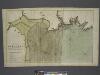
The coast of BRETAGNE from GRANVILLE to CAPEFREHEL
from The sea-atlas : containing an hydrographical description of most of the sea-coasts of the known parts of the world.
Northwestern Normandy : natural regions
1 : 550000 Provisional ed. Relief shown by shading. "Map no. 2369, 8 July 1943." "Restricted." "Reliability code: 00--2B--2." United States. Office of Strategic Services. Research and Analysis Branch [Washington, D.C.] : R & A, OSS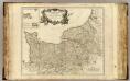
Normandie.
1 : 550000 Robert de Vaugondy, Gilles, 1688-1766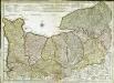
Carte de Normandie
1 Karte : Kupferdruck ; 47 x 65 cm L'Isle; Buache; Dezauche chez Dezauche graveur successeur et possesseur du fond géographique des S.rs Delisle et Buache et chargés de l'entrepo't général des cartes de la marine rue des Noyers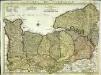
Carte de Normandie
1 Karte auf 2 Blättern : Kupferdruck ; 47 x 64 cm L'Isle; Condet chez J. Cóvens et C. Mortier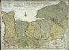
Carte de Normandie
1 Karte : Kupferdruck ; 47 x 65 cm L'Isle chez l'auteur sur le quay de l'Horloge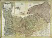
Carte de la province de Normandie
1 Karte : Kupferdruck ; 48 x 68 cm Duperrier chez l'auteur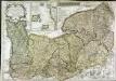
Le Duché et gouvernement de Normandie
1 Karte : Kupferdruck ; 48 x 68 cm Crépy; Crépy chez Crepy