Project
Community
News
My maps
Mapa catalogado
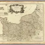
Normandie.
Título completo:
Normandie.
Editorial:
Les Auteurs
Tamaño físico:
20 x 30 cm
Escala del mapa:
1:550 000
Historia