Project
Community
News
My maps
Cataloged map
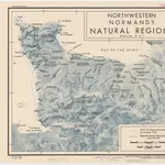
Northwestern Normandy : natural regions
Full title:
Northwestern Normandy : natural regions
Publisher:
[Washington, D.C.] : R & A, OSS
Physical Size:
20 x 30 cm
Map scale:
1:550 000
History