Maps of Moray
Partie septentrionale de l'Ecosse
1 Karte : Kupferdruck ; 50 x 82 cm s.n.
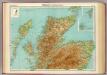
Scotland NW.
1 : 486830 Stanford, Edward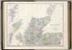
Scotland N.
1 : 633600 Johnston, Alexander Keith, 1804-1871
Carte des Iles Britanniques.
1 : 2600000 Vivien de St Martin, L.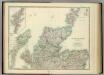
Scotland (northern sheet).
1 : 633600 Johnston, Alexander Keith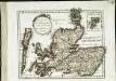
Des Königreichs Scotland nördlicher Theil oder Das Hochland
1 Karte : Kupferdruck ; 20 x 26 cm Reilly F. J. J. von Reilly
Scotland 3.
1 : 760320 Letts, Son & Co.
Scotland III.
1 : 765000 Society for the Diffusion of Useful Knowledge (Great Britain)
Paskaart vande noord cust van Schotland als mede de eylanden van Hitlandt en Fero. Naaukeuring opgestelt en van veel fouten verbetert ... / Iohannes van Keulen.
Keulen, Johannes van, 1654-1715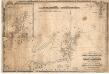
A chart of the north coast of Scotland including the Orkney and Shetland Islands.
Blachford, W.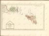
Scotland NW.
1 : 500000 Cary, John, ca. 1754-1835
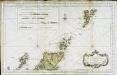
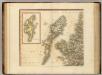
Les isles Orcadney, ou Orkney; Schetland, ou Hetland; et de Fero, ou Farre
1 Karte : Kupferdruck ; 41 x 52 cm Sanson; Fortin chez le Sr. Fortin ing.r pour les globes rue de la Harpe près celle du Foin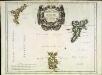
Les isles Orcadney, ou Orkney; Schetland, ou Hetland; et de Fero, ou Farre
1 Karte : Kupferdruck ; 41 x 52 cm Sanson; Mariette chez Pierre Mariette rue St. Iacques a l'Esperance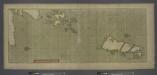
A large draught of the ISLES of ORKNEY with the north part of SCOTLAND
from The sea-atlas : containing an hydrographical description of most of the sea-coasts of the known parts of the world.
A general map of Scotland and islands thereto belonging, 2
1 Blatt : 91 x 62 cm s.n.
The East Coast of Scotland with the Isles of Orkney and Shetland.
Collins, Greenvile, fl. 1669-1698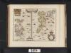
Orcadum et Shetlandiae Insularum accuratissima descriptio.
Blaeu, Willem Janszoon, 1571-1638 Blaeu, Joan, 1596-1673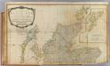
Scotland (north)
1 : 450000 Robert Laurie & James Whittle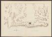
Scotiae Regnum [Karte], in: Atlas, sive, Cosmographicae meditationes de fabrica mundi et fabricati figura, S. 86.
1 Karte aus Atlas Mercator, Gerhard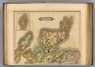
Scotland (northern)
1 : 700000 Lizars, Daniel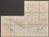
Scotiae Regnum [Karte], in: Gerardi Mercatoris Atlas, sive, Cosmographicae meditationes de fabrica mundi et fabricati figura, S. 106.
1 Karte aus Atlas Mercator, Gerhard Montanus, Petrus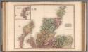
Scotland, northern part.
1 : 518000 Pinkerton, John, 1758-1826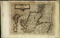
Scotiae regnvm
1 Karte : Kupferdruck ; 17 x 24 cm Mercator Cloppenburgh
Scotiae regnvm
1 Karte : Kupferdruck ; 33 x 44 cm Mercator; Hondius Henricus Hondius
Scotiæ regnvm
1 Karte : Kupferdruck ; 33 x 44 cm Mercator; Hondius Jodocus Hondius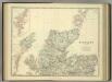
Scotland (northern sheet).
1 : 633600 Johnston, Alexander Keith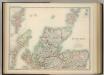
Scotland (northern sheet).
1 : 633600 Johnston, W. & A.K.
Scotiae regnum
1 : 1100000