Maps of Highland

Carte des Iles Britanniques.
1 : 2600000 Vivien de St Martin, L.
Carte physique et routiere de l'Ecosse
1 : 1500000 Skotsko Starling, Thomas Virtue, George George Virtue
Schotland.
1 : 1550000 Radefeld, Carl Christian Franz, 1788-1874
Karte von Scotland
1 : 900000 Skotsko Dorret, J. Schraembl, Franz Anton F.A. Schraembl
Karte von Scotland
1 : 900000 Skotsko Dorret, J. Schraembl, Franz Anton F.A. Schraembl
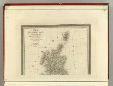
Ecosse.
1 : 2400000 Bonne, Rigobert, 1727-1794
Ecosse.
1 : 1740000 Migeon, J.
North Britain or Scotland divided into its counties
1 : 800000 Skotsko Kitchin, Thomas Faden, William Wm. Faden
Scotland.
1 : 3000000 Seaman, James V.
Andrews's new and accurate travelling map of the roads of Scotland, shewing the distances between the towns &c.
1 : 1
Scotland
1 : 1370000 Skotsko Weiland, Karl Ferdinand Maedel, Carl Jos. Geograph. Institut
Scotland.
1 : 1500000 Colton, G.W.
Isles britanniques
1 Karte : Kupferdruck ; 31 x 42 cm Mentelle; Tardieu; André Mentelle
Scotland.
1 : 1550000 Lavoisne, M.
Scotland
1 : 785000 Orkneje (Skotsko) George Philip & Son
Des Königreichs Scotland nördlicher Theil oder Das Hochland
1 Karte : Kupferdruck ; 20 x 26 cm Reilly F. J. J. von Reilly
Scotland.
1 : 610000 Hughes, William
Carte de l'Ecosse
1 : 1950000 Skotsko Bonne, Rigobert André
Charte von Schottland
Skotsko Streit, Friedrich Wilhelm
Scotland.
1 : 2100000 Darton, William
Scotland 3.
1 : 760320 Letts, Son & Co.
Composite: Scotland.
1 : 500000 Cary, John, ca. 1754-1835
Composite: Scotland.
1 : 486830 Stanford, Edward
Das Königreich Scotland
1 Karte : Kupferdruck ; 20 x 27 cm Reilly F. J. J. von Reilly
Karte von Scotland
1 Karte : Kupferdruck ; 54 x 50 cm Schrämbl; Dorret; Stenger zu finden in eigenem Verlage Schrämbl
L'Escosse royaume
1 Karte : Kupferdruck ; 39 x 49 cm Sanson; Fortin chez Fortin ing.r mécanicien du roi pour les globes rue de la Harpe près celle du Foin
A new [and] accurate map of Scotland or North Britain
1 Karte : Kupferdruck ; 41 x 34 cm Bowen s.n.
A correct map of Scotland from new surveys
1 Karte auf 2 Blättern : Kupferdruck ; 75 x 59 cm Dorret s.n.
L'Escosse royaume
1 Karte : Kupferdruck ; 39 x 50 cm Sanson; Mariette chez Pierre Mariette rue St. Iacques a l'esperance