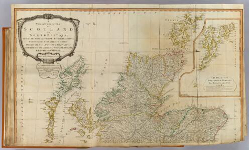
Maps of Highland
Scotland (north)
1 : 450000 Robert Laurie & James Whittle
Scotiae regnum
1 : 1100000
Scotiae regnvm
1 Karte : Kupferdruck ; 17 x 24 cm Mercator Cloppenburgh
Scotiae regnvm
1 Karte : Kupferdruck ; 33 x 44 cm Mercator; Hondius Henricus Hondius
Scotiæ regnvm
1 Karte : Kupferdruck ; 33 x 44 cm Mercator; Hondius Jodocus Hondius
Scotiae Regnum [Karte], in: Gerardi Mercatoris Atlas, sive, Cosmographicae meditationes de fabrica mundi et fabricati figura, S. 106.
1 Karte aus Atlas Mercator, Gerhard Montanus, Petrus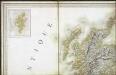
Carte des iles britanniques ou Royaume-Uni de la Grande Bretagne et d'Irlande, 1
2 Blätter : je 50 x 39 cm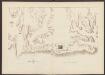
Scotiae Regnum [Karte], in: Atlas, sive, Cosmographicae meditationes de fabrica mundi et fabricati figura, S. 86.
1 Karte aus Atlas Mercator, Gerhard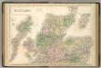
Scotland.
1 : 610000 Hughes, William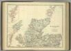
Scotland (northern sheet).
1 : 633600 Johnston, Alexander Keith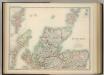
Scotland (northern sheet).
1 : 633600 Johnston, W. & A.K.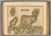
Scotland (northern)
1 : 700000 Lizars, Daniel
L'Escosse delà le Tay
1 Karte : Kupferdruck ; 39 x 52 cm Sanson; Fortin; Gordon; Pont chez Fortin ing.r mecanicien du roi pour les globes rue de la Harpe pres celle du Foin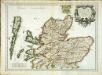
L'Escosse delà le Tay
1 Karte : Kupferdruck ; 39 x 53 cm Sanson; Mariette; Gordon; Pont chez Pierre Mariette rue St. Iacques a l'esperance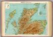
Scotland - northern section.
1 : 633600 John Bartholomew & Co.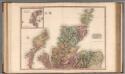
Scotland, northern part.
1 : 518000 Pinkerton, John, 1758-1826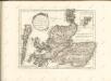

Composite: Scotland.
1 : 518000 Pinkerton, John, 1758-1826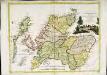
La Scozia settentrionale
1 Karte : Kupferdruck ; 30 x 39 cm Zatta; Zuliani; Pitteri presso Antonio Zatta
Scotland II.
1 : 765000 Society for the Diffusion of Useful Knowledge (Great Britain)
Scotland 2.
1 : 760320 Letts, Son & Co.
Scotland NE.
1 : 486830 Stanford, Edward
Western Isles.
Thomson, John, 1777- ca. 1840 Johnson, William, fl. 1806-1840
Western Isles.
Thomson, John, 1777- ca. 1840 Johnson, William, fl. 1806-1840
Western Isles.
Thomson, John, 1777- ca. 1840 Johnson, William, fl. 1806-1840
Tabula Leogi et Haraiae, ac Skiae vel Skianae Insularum. [Karte], in: Novus atlas absolutissimus, Bd. 8, S. 169.
1 Karte aus Atlas Janssonius Offizin
A general map of Scotland and islands thereto belonging, 1
2 Blätter : 90 x 76 cm s.n.
EXTIMA SCOTIÆ | SEPTENTRIONALIS ORA, | ubi Provinciæ sunt | ROSSIA, SVTHERLANDIA, CATHENESIA, | STRATH-NAVERNIÆ, | cum vicinis regiunculis quæ eis subsunt, etiamque | MORAVIA.
R. Gordonius à Strath-loch collegit et descripsit. [Amsterdam : Joan Blaeu]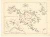
Map of St Kilda or Hirta and adjacent islands...
Mathieson, John