Maps of Metropolitan France

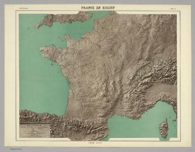
France en Relief.
Vivien St Martin, L.
Frankreich und die Schweiz.
1 : 3700000 Berghaus, Hermann
Composite: France.
1 : 4400000 Vivien de St Martin, L.
Frankreich und die Schweiz
Hand-Atlas über alle Theile der Erde und über das Weltgebäude Stieler, Adolf Justus Perthes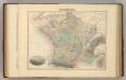
France en 1789.
1 : 3300000 Migeon, J.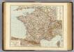
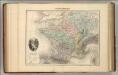
France.
1 : 3000000 Andree, Richard; Times (London, England)
Frankreich und die Schweiz
Handatlas über alle Theile der Erde und über das Weltgebäude Stieler, Adolf Justus Perthes
Sprachkarte von Frankreich.
1 : 3700000 Berghaus, Heinrich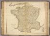
France.
1 : 2300000 Playfair, Principal
Sprechkarte von Frankreich
Zweiter Band, enthaltend in vier Abtheilungen die Vertheilung der Organismen: 5. Pflanzen-Geographie, 6. Thier-Geographie, 7. Anthropographie, 8. Ethnographie Humboldt, Alexander von Verlag von Justus Perthes
Charte von Frankreich
1 : 900000 Francie Verlage des Kunst und Industrie Compoirs
Frankreich
Schul-Atlas in 36 Karten Völter, Daniel Verlag der J.M. Dannheimer'schen Buchhandlung
Jak vzniká mapa

CHARTE von FRANKREICH nach der neuesten Eintheilung in 22. Militair-Divisionen 86. Departemente mit Beziehung auf die alte Eintheilung in Provinzen entworfen
Elba (Itálie)
Charte von Frankreich nach der neuesten Eintheilung in 22. Militair-Divisionen 86. Departemente mit Beziehung auf die alte Eintheilung in Provinzen entworfen
Elba (Itálie)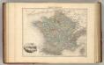
France Politique.
1 : 3700000 Migeon, J.
Galliae supra omnes in hac forma editiones locupletißima et exatißima descriptio. [Karte], in: Gerardi Mercatoris et I. Hondii Newer Atlas, oder, Grosses Weltbuch, Bd. 2, S. 16.
1 Karte aus Atlas Mercator, Gerhard und Hondius, Jodocus Jansson, Jan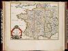
La France en toute son estendue sous le Roy Louis le Grand l'an 1682 / par P. du Val
1 : 2500000 Annotatie: Origineel is Blad 13 in atlas factice Duval, Pierre A Paris : chez l'auteur
Composite: Frankreich.
1 : 1700000 Handtke, Friedrich H.
Gallia concinnata ad magnum numerum mapparum particularium manu scriptarum vel impreßarum juxta genuinum situm locorum et collatarum cum itinerariis veteribus et recentioribus
1 : 3600000 Francie Delisle, Guillaume Seutter, Matthäus Matth. Seutter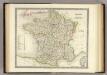
France.
1 : 3150000 Teesdale, Henry

Frankreich.
1 : 3700000 Berghaus, Heinrich; Flemming, Carl; Sohr, Karl
Frankreich
Hypsometrischer Atlas Ziegler, Jakob Melchior Topogr. Anstalt v. J. Wurster u. Comp.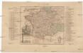
Kriegs Schauplatz zwischen Franckreich u. Ostreich 1792
1 : 2845000 Francie
Frankreich

Charte féodale de la France
1 : 2370000 Francie Perrot, A. M. Barante.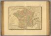
France en 1789.
1 : 2950000 Picquet, C.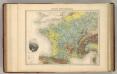
France Hypsometrique.
1 : 3700000 Migeon, J.