Maps of Metropolitan France

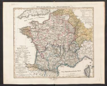
Sprechkarte von Frankreich
Zweiter Band, enthaltend in vier Abtheilungen die Vertheilung der Organismen: 5. Pflanzen-Geographie, 6. Thier-Geographie, 7. Anthropographie, 8. Ethnographie Humboldt, Alexander von Verlag von Justus Perthes
Frankreich und die Schweiz
Handatlas über alle Theile der Erde und über das Weltgebäude Stieler, Adolf Justus Perthes
Frankreich und die Schweiz
Hand-Atlas über alle Theile der Erde und über das Weltgebäude Stieler, Adolf Justus Perthes
Frankreich und Umgebungen von Paris
Stieler's Hand-Atlas Stieler, Adolf bei Justus Perthes
Composite: France.
1 : 4400000 Vivien de St Martin, L.
Frankreich und die Schweiz.
1 : 3700000 Berghaus, Hermann
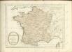
Frankreich

Frankreich
Schul-Atlas in 36 Karten Völter, Daniel Verlag der J.M. Dannheimer'schen Buchhandlung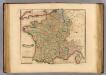
France, departments.
1 : 2900000 Lizars, Daniel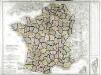
Carte de la France
1 Karte : Kupferdruck ; 54 x 64 cm Poirson; Jean chez Jean M.d d'estampes rue Jean de Beauvais n.o 32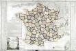
Carte de la république de France
1 Karte : Kupferdruck ; 49 x 64 cm Poirson; Glot; Esnault; Rapilly; Besançon chez Esnauts et Rapilly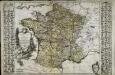
Nouvelle carte de la France
1 Karte : Kupferdruck ; 50 x 60 cm, Bildgrösse 52 x 76 cm Brion de la Tour; Esnault; Rapilly chez Esnauts et Rapilly rue Saint Jacques à la ville de Coutance
Gallia
1 Karte : Kupferdruck ; 46 x 55 cm Seutter; L'Isle excusa et venales exhibita à M. Seutter sac. c. Maj. geogr. Aug
Gallia
1 Karte : Kupferdruck ; 46 x 55 cm Seutter; L'Isle excusa et venales exhibita à Matth: Seutter calc
La France
1 Karte : Kupferdruck ; 44 x 59 cm Simonneau; L'Isle chéz l'auteur sur le quai de l'Horloge a l'aigle d'or
Charte von Frankreich
1 : 900000 Francie Verlage des Kunst und Industrie Compoirs
Sprachkarte von Frankreich.
1 : 3700000 Berghaus, Heinrich
Frankreich
Geographischer Atlas über alle Theile der Erde Ziegler, Jakob Melchior Verlag von Joh. Wurster um Comp.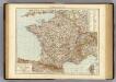
France.
1 : 3000000 Andree, Richard; Times (London, England)
Frankreich mit Piemont, Schweiz, Baden, Württemberg, Rhein-Provinz, Hessen und Belgien
1 : 1200000 Belgie Geographisches Institut
Frankreich

France en Relief.
Vivien St Martin, L.
Frankreich
Hypsometrischer Atlas Ziegler, Jakob Melchior Topogr. Anstalt v. J. Wurster u. Comp.
France.
Andriveau-Goujon, J.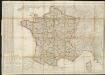
Carte de France divisée en 86 departemens
1 : 2060000
Charte von Frankreich in Departements eingetheilt
1 : 2500000 Francie Joh. Walch
Frankreich
Geographischer Atlas über alle Theile der Erde Ziegler, Jakob Melchior Verlag von Dietrich Reimer
France.
1 : 3150000 Teesdale, Henry
Frankreich
Adolf Stieler's Handatlas über alle Theile der Erde und über das Weltgebäude Stieler, Adolf Justus Perthes