Maps of Metropolitan France

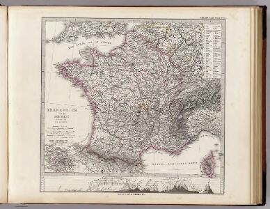
Frankreich und die Schweiz.
1 : 3700000 Berghaus, Hermann
France en Relief.
Vivien St Martin, L.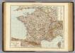
France.
1 : 3000000 Andree, Richard; Times (London, England)
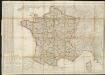
Frankreich und die Schweiz
Handatlas über alle Theile der Erde und über das Weltgebäude Stieler, Adolf Justus Perthes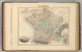
France en 1789.
1 : 3300000 Migeon, J.
Sprechkarte von Frankreich
Zweiter Band, enthaltend in vier Abtheilungen die Vertheilung der Organismen: 5. Pflanzen-Geographie, 6. Thier-Geographie, 7. Anthropographie, 8. Ethnographie Humboldt, Alexander von Verlag von Justus Perthes
Frankreich und die Schweiz
Hand-Atlas über alle Theile der Erde und über das Weltgebäude Stieler, Adolf Justus Perthes
Frankreich
Schul-Atlas in 36 Karten Völter, Daniel Verlag der J.M. Dannheimer'schen Buchhandlung
Charte von Frankreich
1 : 900000 Francie Verlage des Kunst und Industrie Compoirs
Composite: France.
1 : 4400000 Vivien de St Martin, L.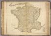
France.
1 : 2300000 Playfair, Principal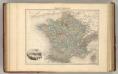
France Politique.
1 : 3700000 Migeon, J.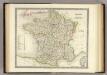
France.
1 : 3150000 Teesdale, Henry
Frankreich und Umgebungen von Paris
Stieler's Hand-Atlas Stieler, Adolf bei Justus Perthes
Sprachkarte von Frankreich.
1 : 3700000 Berghaus, Heinrich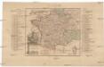
Kriegs Schauplatz zwischen Franckreich u. Ostreich 1792
1 : 2845000 Francie
CHARTE von FRANKREICH nach der neuesten Eintheilung in 22. Militair-Divisionen 86. Departemente mit Beziehung auf die alte Eintheilung in Provinzen entworfen
Elba (Itálie)
Charte von Frankreich nach der neuesten Eintheilung in 22. Militair-Divisionen 86. Departemente mit Beziehung auf die alte Eintheilung in Provinzen entworfen
Elba (Itálie)
France en 1789.
1 : 2950000 Picquet, C.
Frankreich
Geographischer Atlas über alle Theile der Erde Ziegler, Jakob Melchior Verlag von Joh. Wurster um Comp.
Frankreich

Frankreich
Hypsometrischer Atlas Ziegler, Jakob Melchior Topogr. Anstalt v. J. Wurster u. Comp.
France.
Andriveau-Goujon, J.
Frankreich
E. von Sydow's Schul-Atlas in sechs und dreissig Karten Sydow, Emil von bei Justus Perthes
Jak vzniká mapa

Frankreich
[Allgemeiner Atlas über alle Theile der Erde in 29 Blättern] Ziegler, Jakob Melchior Top. Anstalt v. J. Wurster u. Comp.
Composite: Frankreich.
1 : 1700000 Handtke, Friedrich H.
Galliae supra omnes in hac forma editiones locupletißima et exatißima descriptio. [Karte], in: Gerardi Mercatoris et I. Hondii Newer Atlas, oder, Grosses Weltbuch, Bd. 2, S. 16.
1 Karte aus Atlas Mercator, Gerhard und Hondius, Jodocus Jansson, Jan
Frankreich
Geographischer Atlas über alle Theile der Erde Ziegler, Jakob Melchior Verlag von Dietrich Reimer