Maps of Metropolitan France


Frankreich

Frankreich
Schul-Atlas in 36 Karten Völter, Daniel Verlag der J.M. Dannheimer'schen Buchhandlung
Frankreich
Grosser Hand-Atlas über alle Theile der Erde in 170 Karten Meyer, J. Verlag des Bibliographischen Instituts
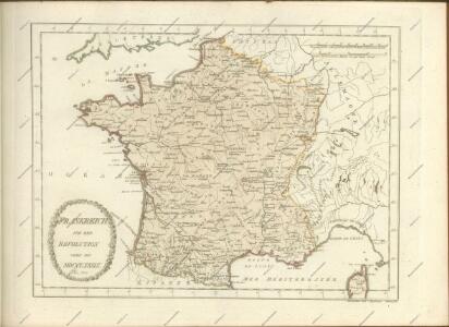
Sprechkarte von Frankreich
Zweiter Band, enthaltend in vier Abtheilungen die Vertheilung der Organismen: 5. Pflanzen-Geographie, 6. Thier-Geographie, 7. Anthropographie, 8. Ethnographie Humboldt, Alexander von Verlag von Justus Perthes

Frankreich und die Schweiz
Hand-Atlas über alle Theile der Erde und über das Weltgebäude Stieler, Adolf Justus Perthes
La France
1 Karte : Kupferdruck ; 51 x 64 cm Jaillot; Cordier chez le Sr. Jaillot
La carte nouvelle de la France, ses conquetes, ses acquisitions, et ses bornes, par la paix de Ris-wick
1 : 2500000 corrigée par ordre du Roy et dressée sur les dernieres observations de Mrs. de l'Academie Royale des Sciences, par N. de Fer door Mess.rs van de Koninklyke Wetenschappen op order van de koningh verbetert tot Utrecht : by Caspar Specht
Frankreich und die Schweiz.
1 : 3700000 Berghaus, Hermann
Carte pittoresque et maritime de la France : indiquant la division politique et administrative ... / par A.M. Perrot ; revue et augm. par A. Vuillemin
1 : 1350000 Annotatie: Met aansluitende inzet van Corsica; Met afb. van bezienswaardigheden; Annotatie geografische gegevens: Grenzen en spoorlijnen gekleurd Perrot, A. M.; Vuillemin, A. Paris : Fatout
Frankreich und die Schweiz
Handatlas über alle Theile der Erde und über das Weltgebäude Stieler, Adolf Justus Perthes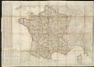
Carte de France divisée en 86 departemens
1 : 2060000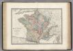
France en 1789.
1 : 3000000 Levasseur, E.
Charte von Frankreich
1 : 900000 Francie Verlage des Kunst und Industrie Compoirs
Composite: France.
1 : 4400000 Vivien de St Martin, L.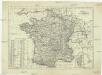
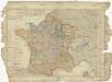
Königreich Frankreich
1 : 4000000 Francie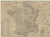
Königreich Frankreich
Francie
Frankreich
1 : 3640000 Francie Mollo, Florian Florian Mollo
Frankreich
1 : 3640000 Francie Florian Mollo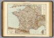
France.
1 : 3000000 Andree, Richard; Times (London, England)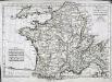
Mappa Galliæ antiquæ
1 Karte : Kupferdruck ; 21 x 31 cm Bonne; Perrier; André s.n.
France - Belgium and Switzerland.
1 : 3380000 Sharpe, J.
Carte Physique et Mineralogique de la France.
1 : 3500000 Malte-Brun, Conrad, 1775-1826
Carte comparative des divisions anciennes et modernes de la France
1 Karte : Kupferdruck ; 33 x 41 cm Mentelle; Tardieu; Dubuisson Mentelle
Carte physique de la France
1 Karte : Kupferdruck ; 34 x 41 cm Mentelle; Tardieu; Dubuisson Mentelle
Königreich Frankreich

France en Relief.
Vivien St Martin, L.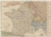
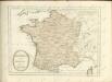
Karte von Frankreich
1 : 2056000 Francie Mollo, Tranquillo T. Mollo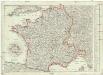
Karte von Frankreich
1 : 2056000 Francie Müller, Franz T. Mollo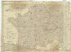
Karte von Frankreich
1 : 2060000 Francie Mollo, Tranquillo T. Mollo und Comp.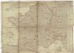
Karte von Frankreich
1 : 2060000 Francie Mollo, Tranquillo T. Mollo und Comp.