Maps of Germany
Central Europe.
1 : 2000000 Hughes, William
Charte von Deutschland zu dem Meilen-Zeiger
1 : 222000 Německo Schreiber, Johann Georg
L'Allemagne Divisée en Havte et Basse, et par Cercles, Subdivisée en Etats Ecclesiastiques, Laiques et Villes Imperiales
1 : 2400000 Mollova mapová sbírka Du Tralage, Jean Nicolas Nolin, Jean Baptiste
Der Deutsch-französische Kriegsschauplatz
1 : 900000 Evropa severozápadní König, Gustav Moriz Perles
Germania divisa in decem Circulos,
1 : 2400000 Mollova mapová sbírka Valk, Gerhard Valck, Gerard
Hydrographia Germaniae
Evropa střední Homann, Johann Baptist operâ Ioh. Baptistae Homani
Hydrographia Germaniae
1 : 2500000 Evropa střední Homann, Johann Baptist J.B. Homann
Birds eye view of the seat of War in Europe
1 : 1
L'Empire d'Allemagne
1 : 2500000 Mollova mapová sbírka Jaillot, Alexis-Hubert Jaillot, Alexis Hubert
[Střední Evropa]
Evropa střední
[35][35] Accuratissima Germaniae tabula, uit: Atlas sive Descriptio terrarum orbis
Annotatie: Gedigitaliseerde versie. Amsterdam. Heiloo : Picturae (vervaardiger), 2015. tiff-bestand. Gedigitaliseerd: 07-01-2015; Origineel: Universiteitsbibliotheek Vrije Universiteit (XL.05127.-) ; Netherlands; Titelpagina ontbreekt Wit, Frederik de Amsterdam : Frederick de Wit
Imperio d'Allemagna
1 : 3000000 Mollova mapová sbírka Sanson, Nicolas Widman, Giorgio De Rossi, Giovanni Giacomo
Teutschland die Niederlande und die Schweiz
1 : 2860000 Nizozemsko Streit, Friedrich Wilhelm Boreux, J. J. C. Hinrichssche Buchhandlung
Neueste Eisenbahn- und Kriegs-Karte
Evropa střední A.H. Payne
Germania Antiqua.
1 : 2500000 Playfair, Principal
Imperii Romano-Germanici in svos statvs et circvlos divisi tabvla generalis in usus iuventutis erudiendae accommodata
1 : 2560000 Evropa střední Homann, Johann Baptist Schatz, Johann Jakob Schatz
Imperii Romano-Germanici in svos statvs et circvlos divisi tabvla generalis in usus iuventutis erudiendae accommodata
1 : 2600000 Evropa střední Homann, Johann Baptist Schatz, Johann Jakob Ioh. Bapt. Homann
Accuratissima Germaniae tabula
1 : 2500000 Evropa střední Danckerts, Justus a Iusto Danckerts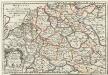
Die West See auch Das Teutsche Meer von den Hollaendern aber die Nordsee geheissen
1 : 500000 Mollova mapová sbírka Bodenehr, Gabriel Bodenehr, Gabriel
S. Imperium Romano-Germanicum oder Teutschland mit seinen angräntzenden Königreichen und Provincien
1 : 2420000 Evropa střední Reichelt, Julius Hogeboom, A. durch Nicolaum Visscher
S. Imperium Romano-Germanicum oder Teutschland mit seinen angräntzenden Königreichen und Provincien
1 : 2450000 Evropa střední Reichelt, Julius Hogeboom, Andries durch Nicolaum Visscher
Neueste Post- und Eisenbah-Charte von Deutschland und der angränzenden Ländern für Extraposten, Couriere, Diligengen, u. Eilwägen
Belgie Bauer & Raspe

Mappa Geographica indicans, quibus in locis per totam Germaniam bello tricennali Rex Sueciae Gustavus Adolphus, ejusque Confoederati felicia ut plurimum praelia comiserint, quas urbes tenuerint et A. 1648 amore Pacis vi tractatum Westphalicarum restituere promiserint
1 : 2500000 Mollova mapová sbírka Seutter, Matthäus Seutter, Matthäus
Allemagne occidentale.
1 : 2000000 Andriveau-Goujon, J.
Germania
1 Karte : Kupferdruck ; 36 x 48 cm Ortelius s.n.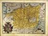
Germania
1 Karte : Kupferdruck ; 36 x 48 cm Ortelius s.n.
Accuratissima Germaniae Tabula Denuo in lucem edita
1 : 2400000 Mollova mapová sbírka Wit, Frederik de Ottens, Josua
Accuratißima totius Germaniae Tabula Novissime in lucem edita
1 : 2400000 Mollova mapová sbírka Funck, David Homann, Johann Baptist Funck, David