Maps of Germany
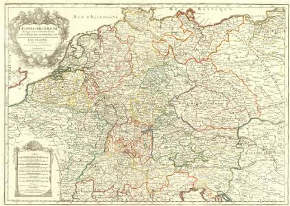
L'Empire d'Allemagne
1 : 2500000 Mollova mapová sbírka Jaillot, Alexis-Hubert Jaillot, Alexis Hubert
L'Empire d'Allemagne
Mollova mapová sbírka Fer, Nicolas de Danet, Guillaume
Neueste Post- und Eisenbah-Charte von Deutschland und der angränzenden Ländern für Extraposten, Couriere, Diligengen, u. Eilwägen
Belgie Bauer & Raspe
[Botanische Karte von Deutschland; enthaltend die Statistik der vornehmsten Pflanzen-Familien so wie die Isotheren und Isochimenen]
Zweiter Band, enthaltend in vier Abtheilungen die Vertheilung der Organismen: 5. Pflanzen-Geographie, 6. Thier-Geographie, 7. Anthropographie, 8. Ethnographie Humboldt, Alexander von Verlag von Justus Perthes
Germania
1 Karte : Kupferdruck ; 36 x 48 cm Ortelius s.n.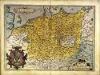
Germania
1 Karte : Kupferdruck ; 36 x 48 cm Ortelius s.n.
L'Allemagne divisée en ses cercles
1 : 2500000 Mollova mapová sbírka Fer, Nicolas de Loon, Herman van Fer, Nicolas de
L'Allemagne divisée en ses cercles
1 : 2500000 Mollova mapová sbírka Fer, Nicolas de Loon, Herman van Fer, Nicolas de
Geschäfts- und Reise-Karte von Deutschland und den angrenzenden Ländern
Evropa střední Koenig, Theophil R. Drawert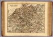
Carte exacte des postes et routes de l'Empire d'Allemagne divisee en ses cercles.
1 : 2500000 Covens et Mortier
Germania
1 : 3100000 Mollova mapová sbírka Ortelius, Abraham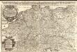
Das Heyl. Römische Reich Teutscher Nation
1 : 2100000 Mollova mapová sbírka Sanson, Guillaume Hipschmann, Sigmund Gabriel Hofmann, Johann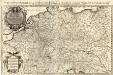
Das Teutsche Keiserthum samt allen darzu gehörigen Chur- und Fürstenthümen Ertz- und Bistumen, Grav- und Herrschaften, auch andern theils daran gräntzenden Ländern und Statten
1 : 2100000 Mollova mapová sbírka Hoffmann, Johannes Hoffmann, Johann
[Übersicht der Meteorologischen Stationen in Deutschland, der Schweiz, den Niederlanden]
Erster Band, enthaltend in vier Abtheilungen die Erscheinungen der anorganischen Natur: 1. Meteorologie und Klimatographie. 2. Hydrologie und Hydrographie. 3. Geologie. 4. Tellurischer Magnetismus Humboldt, Alexander von Verlag von Justus Perthes
Nieuwe kaart van Duitschland, opgemaakt volgens de naukeurigste waarneemingen
1 : 7250000 [S.l.] : [s.n.]
Karte von Deutschland
1 : 1880000 Evropa střední Reilly, Franz Johann Josef von Benedicti, Hieronymus Franz Joh. Jos. von Reilly
Karte von Deutschland
1 : 1880000 Evropa střední Reilly, Franz Johann Josef von Benedicti, Hieronymus Franz Joh. Jos. von Reilly
Karte von Deutschland nach Sotzmann
1 : 1880000 Německo Reilly, Franz Johann Josef von Benedicti, Hieronymus Franz Joh. Jos. von Reilly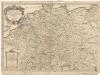
L'empire d'Allemagne
1 : 2600000 Evropa střední Sanson, Guillaume Cordier, Louis chez H. Iaillot
Deutschland, oder, Deutsche Bundesstaaten
1 : 185000 Německo Tranquillo Mollo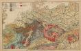
Geologie. II. Mitteleuropa
1 : 3500000 Europa Geologie
Allgemeine Postkarte von Deutschland zur Uebersicht
Německo Alberti, Ignaz im von Reillyschen Landkarten und Kunstwerke Verschleiss Komptoir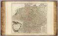
Allemagne.
1 : 2250000 Robert de Vaugondy, Gilles, 1688-1766
Karte von Deutschland und einem Theile der angrenzenden Länder mit Angabe sämmtlicher Eisenbahnen
1 : 2300000 Evropa střední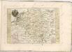

Neu-vermehrte Post-Charte durch gantz Teutschland nach Italien, Franckreich, Niederland, Preußen, Polen, und Ungarn ec
1 : 2470000 Německo Nell, Johann Peter Paar, Carl Joseph von Iohann Baptist Homann
Neu-vermehrte POST-CHARTE durch gantz TEUTSCHLAND nach Italien, Franckreich, Niederland, Preußen, Polen, und Ungarn etc
1 : 2600000 Evropa střední Nell, Johann Peter Homann, Johann Baptist Iohann Baptist Homann
[Neu-vermehrte Post-Charte durch gantz Teutschland nach Italien, Franckreich, Niederland, Preußen, Polen, und Ungarn etc
1 : 2470000 Francie Nell, Johann Peter Homann, Johann Baptist Iohann Baptist Homann
Neu-vermehrte Post-Charte durch gantz Teutschland nach Italien, Franckreich, Niederland, Preußen, Polen, und Ungarn etc
1 : 2470000 Francie Nell, Johann Peter Homann, Johann Baptist Iohann Baptist Homann