Maps of Germany

[35][35] Accuratissima Germaniae tabula, uit: Atlas sive Descriptio terrarum orbis
Annotatie: Gedigitaliseerde versie. Amsterdam. Heiloo : Picturae (vervaardiger), 2015. tiff-bestand. Gedigitaliseerd: 07-01-2015; Origineel: Universiteitsbibliotheek Vrije Universiteit (XL.05127.-) ; Netherlands; Titelpagina ontbreekt Wit, Frederik de Amsterdam : Frederick de Wit
Germania. [Karte], in: Theatrum orbis terrarum, S. 102.
1 Karte aus Atlas Ortelius, Abraham
Germania. [Karte], in: Theatrum orbis terrarum, S. 40.
1 Karte aus Atlas Ortelius, Abraham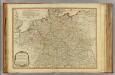
Germany.
1 : 2400000 Robert Laurie & James Whittle
Neueste Eisenbahn-Karte von Deutschland und den angrenzenden Ländern
Evropa střední Walseck, Georg Georg Walseck
Hydrographica Germaniae...

Botanische Karte von Deutschland.
1 : 3700000 Berghaus, Heinrich
L'Allemagne Divisée en Havte et Basse, et par Cercles, Subdivisée en Etats Ecclesiastiques, Laiques et Villes Imperiales
1 : 2400000 Mollova mapová sbírka Du Tralage, Jean Nicolas Nolin, Jean Baptiste
L' Empire D'Allemagne [...] [Karte], in: Atlas nouveau, contenant toutes les parties du monde [...], Bd. 1, S. 161.
1 Karte aus Atlas Sanson, Nicolas Jaillot, Alexis Hubert und Mortier, Pieter
Germania divisa in decem Circulos,
1 : 2400000 Mollova mapová sbírka Valk, Gerhard Valck, Gerard
S. Imperium Romano-Germanicum oder Teutschland mit seinen angräntzenden Königreichen und Provincien
1 : 2420000 Evropa střední Reichelt, Julius Hogeboom, A. durch Nicolaum Visscher
S. Imperium Romano-Germanicum oder Teutschland mit seinen angräntzenden Königreichen und Provincien
1 : 2450000 Evropa střední Reichelt, Julius Hogeboom, Andries durch Nicolaum Visscher
Neueste Eisenbahn- und Kriegs-Karte
Evropa střední A.H. Payne
Geschäfts- und Reise-Karte von Deutschland und den angrenzenden Ländern
Evropa střední Koenig, Theophil R. Drawert
Imperium Romano-Germanicum
1 : 2600000 Mollova mapová sbírka Seutter, Matthäus Seutter, Matthäus
L'Empire d'Allemagne distingué suivant l'étendüe de tous les Estats, Principautés et Souverainetés qui passent ou qui ont passé jusque a present sous le nom d'Allemagne
1 : 2100000 Mollova mapová sbírka Sanson, Guillaume Covens, Johannes I


Prof. W. Liebenow's Kriegskarte von Mitteleuropa

L'Empire d'Allemagne
1 : 2100000 Mollova mapová sbírka Sanson, Guillaume Jaillot, Alexis Hubert
L'Empire d'Allemagne
1 : 2100000 Mollova mapová sbírka Sanson, Guillaume Jaillot, Alexis Hubert
Imperium Romano-Germanicum
1 : 2600000 Mollova mapová sbírka Seutter, Matthäus Seutter, Matthäus
Bez titulu: soubor map pag. 125

[Übersicht der Meteorologischen Stationen in Deutschland, der Schweiz, den Niederlanden]
Erster Band, enthaltend in vier Abtheilungen die Erscheinungen der anorganischen Natur: 1. Meteorologie und Klimatographie. 2. Hydrologie und Hydrographie. 3. Geologie. 4. Tellurischer Magnetismus Humboldt, Alexander von Verlag von Justus Perthes
Post- Reise-Karte von Deutschland mit spezieller Angabe der Eisenbahn- und Dampfschiffahrt-Verbindungen
1 : 1820000 Evropa střední Hagedorn, Fhr. von Löhe, Wilhelm von Piloty & Loehle
Eisenbahn-Karte von Mittel-Europa
1 : 8200000 Evropa střední

Neueste Post-Charte von Deutschland und den angränzenden Ländern : für Extraposten, Couriere, Diligencen u. Eilwagen / mit benützung der besten Materialien gezeichnet
1 : 1000000 Annotatie: Met afstandentabel Nürnberg : Bauer & Raspe
Deutschland, Königr. der Niederlande, Kgr. Belgien und die Schweiz, nebst Theilen der angränzenden Länder
1 : 1500000 Belgie Diez, F. M. Bär, Johann Christoph Justus Perthes
![[35][35] Accuratissima Germaniae tabula, uit: Atlas sive Descriptio terrarum orbis](https://images-0.georeferencer.com/images/iiif/333135926713/full/,300/0/native.jpg)

