Maps of Germany

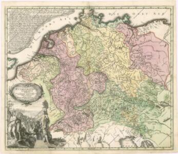
Hydrographica Germaniae...

Neueste Eisenbahn-Karte von Deutschland und den angrenzenden Ländern
Evropa střední Walseck, Georg Georg Walseck

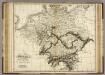
Imperium Romano-Germanicum
1 : 2600000 Mollova mapová sbírka Seutter, Matthäus Seutter, Matthäus
Eisenbahn-Karte von Mittel-Europa
1 : 8200000 Evropa střední
Verbreitung der wichtigsten Kulturgewächse
Evropa střední F.A. Brockhaus Geogr. artist. Anstalt
Post- und Reisekarte von Deutschland, den Niederlanden, Belgien und der Schweiz, nebst Theilen der angrenzenden Länder bis London, Havre de Grace, Turin, Warschau, Kopenhagen
1 : 2500000 Bachmann, Fr. Verlag der Friedrich Kornschen Buchhandlung
Post und Reisekartre von Deutschland...

Post- und Reise-Karte von Deutschland und den anliegenden Laendern bis London, Havre de Grace, Tours, Lyon, Genua, Bologna, Pest, Warschau, Königsberg u. jenseits Kopenhagen, nebst den Haupt-Routen durch das übrige Europa
1 : 1490000 Belgie Diez, F. M. Perthes, Justus Justus Perthes
Post- und Reise-Karte von Deutschland und den anliegenden Ländern bis London, Havre de Grace, Tours, Lyon, Genua, Bologna, Pest, Warschau, Königsberg u. jenseits Kopenhagen, nebst den haupt Routen durch das übrige Europa
1 : 1490000 Belgie Diez, F. M. Justus Perthes
Imperium Romano-Germanicum
1 : 2600000 Mollova mapová sbírka Seutter, Matthäus Seutter, Matthäus
Post- und Reise-Charte von Deutschland und den benachbarten Laendern / nach den neuesten Quellen entw. von C.F. Weiland ; C.J. Maedel sculps.
1 : 1500000 Annotatie geografische gegevens: Grenzen gekleurd Weiland, C. F.; Maedel, C. J. Weimar : Geogr. Institut
Neueste Post-Charte von Deutschland und den angränzenden Ländern : für Extraposten, Couriere, Diligencen u. Eilwagen / mit benützung der besten Materialien gezeichnet
1 : 1000000 Annotatie: Met afstandentabel Nürnberg : Bauer & Raspe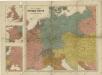
Prof. W. Liebenow's Kriegskarte von Mitteleuropa

Mappa Geographica exhibens Postas
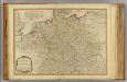
Germany.
1 : 2400000 Robert Laurie & James Whittle
Mappa geographica exhibens postas omnes tam vehiculares quam veredarias totius Germaniae cum earum accurata distantia
1 : 2500000 diligentissime propriis sumptibus excudit Tobias Conrad Lotter Aug. Vindelicor : Tob. Conr. Lotter
Übersicht der Schnellpost und Eilwagen, ... Deutschland

Germania, V. Nova Tabula. [Karte], in: Geographia universalis vetus et nova complectens Claudii Ptolemaei Alexandrini enarrationis libros VIII, S. 314.
1 Karte aus Atlas Münster, Sebastian [und Ptolemaeus, Claudius]
Special-Karte der Eisenbahn- Post- u[nd] Dampfschiff-Verbindungen Mittel-Europa's
1 : 1240000 Evropa střední Raab, Christian Johann Carl Koch, A. C. Flemming
Special-Karte der Eisenbahn- Post- u[nd] Dampfschiff-Verbindungen Mittel-Europa's
1 : 84000 Evropa střední Raab, Christian Johann Carl Müller, H. C. Flemming
Landtaflen
1 Atlas [von Johannes Stumpf] Christoffel Froschower, Zürych
Germania, V. Nova Tabula. [Karte], in: Claud. Ptolemaeus. Geographia lat. cum mappis [...], S. 347.
1 Karte aus Atlas Münster, Sebastian [und Ptolemaeus, Claudius]
Post- Reise-Karte von Deutschland mit spezieller Angabe der Eisenbahn- und Dampfschiffahrt-Verbindungen
1 : 1820000 Evropa střední Hagedorn, Fhr. von Löhe, Wilhelm von Piloty & Loehle
Post- und Eisenbahnkarte von Deutschland und den benachbarten Laendern
1 : 2450000 Evropa střední Weiland, Karl Ferdinand Mädel, C. J. Geograph. Institut
Reisekarte von Deutschland und den angrenzenden Ländern
Evropa střední Mahlmann, H. Morin, F. H. F.H. Morin
Post und Reise-Karte von Deutschland und den anliegenden Ländern für Extraposten, Couriere, Diligencen und Eilwagen
Evropa střední Bär, Johann Christoph Diez, F. M. J. Perthes
Post und Reise-Karte von Deutschland und den anliegenden Ländern für Extraposten, Couriere, Diligencen und Eilwagen
Evropa střední Bär, Johann Christoph Diez, F. M. J. Perthes
Post und Reise-Karte von Deutschland und den anliegenden Ländern für Extraposten, Couriere, Diligencen und Eilwagen
Evropa střední Bär, Johann Christoph Diez, F. M. J. Perthes