Maps of Poland
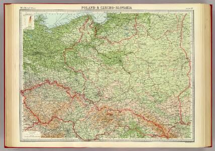
Poland & Czecho-Slovakia.
1 : 2000000 John Bartholomew and Son
Letecká navigační mapa

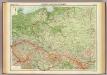
Eastern Germany, distribution of population.
1 : 2400000 Covers Poland, East Prussia, and border areas of Germany and Czechoslovakia. "From: Atlas des deutschen Lebensraumes in Mitteleuropa, plate 27. Data as of 1930-1934." "No. A-6287." United States. Office of Strategic Services. Research and Analysis Branch. [Washington, D.C.] : R & A, OSS
Poland, 1:2,000,000
1 : 2000000
Polen im Herzogthum Warschau und unter Oestreich und Russland getheilt
1 : 2050000 Prusko Müller, Franz T. Mollo
Polen im Herzogthum Warschau und unter Oestreich und Russland getheilt
1 : 2050000 Prusko Müller, Franz Rizzi Zannoni, Giovanni Antonio T. Mollo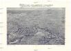
Plastická mapa zemí Sudetských a Karpatských
Evropa střední E. Šolc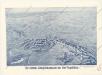
Der östliche Kriegsschauplatz aus der Vogelschau

Karpathenlaender, Polen und Preussen
E. von Sydow's Schul-Atlas in sechs und dreissig Karten Sydow, Emil von bei Justus Perthes
Oorlogskaart van Polen : bijzonder geschikt voor het volgen van de internationale gebeurtenissen / [cartografie] W. Seghers
1 : 1111000 W. Seghers Antwerpen : Patria ; [etc.]
Carte routiere, historique et statistique des états de l'ancienne Pologne indiquantses limites avant sen premiér démembrement er 1772 et son état actuel depuis son dernier partage en 1815
1 : 2970000 Polsko Dufour, A. H. Chodzko, Leonard chez Ch.les Simonneau
[XIII], uit: Geognostische Karte des Oesterreichischen Kaiserstaates mit einem grossen Theile Deutschland's u. Italien / hauptsachlich nach ... Haidinger's geognostischer Karte dieses Staates bearb. von Josef Scheda
1 : 3000000 titelvariant: General-Karte von Europa in 25 Blättern; Annotatie: Bijlage bij: General-Karte von Europa in 25 Blättern. - 1:2.592.000. - 1845-1847 Scheda, Joseph Wien : K.K. Militär. Geografisch. Institut
Polen unter Boleslaw Chrobry und bis 1139
1 : 12000000 Polen Bolesław I., Polen, König
Karpathenländer, Polen und Preussen
Ostmitteleuropa Skizzenbuch
Republika Polská

Carte du Royaume de Pologne
1 : 900000 Bělorusko Nordmann, A. P. H. Gilly Artaria
Nr. 18b. Hindenburgs Züge
Polen Weltkrieg <1914-1918>, Ostfront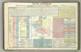
Tableau l'historie des Royaumes de Pologne, de Boheme et de Hongrie.
1 : 6800000 Duval, Henri
Polen
1 : 2100000 Bělorusko Hutter, F. X. Walch, Johann bey Joh. Walch
Poland.
1 : 5100000 Lucas, Fielding Jr.
Polen im Herzogthum Warschau und unter Oestreich und Russland getheilt
1 : 2080000 Bělorusko Mollo, Tranquillo bey T. Mollo
Polen nach den letzten Friedenschlüssen, nebst den angränzenden Laendern
1 : 2200000 Bělorusko Mollo, Tranquillo T. Mollo
Polonia
Polsko
87-88. Poland. The World Atlas.
1 : 1500000 USSR (Union of Soviet Socialist Republics).
Feuille 25 (D IV), uit: Carte géologique internationale de l'Europe : la carte, votée au congrès géologique international de Bologne en 1881, est exécutée conformément aux décisions d'une commission internationale, avec le concours des gouvernements, sous le dir. de M.M. Beyrich et Hauchecorne
Annotatie: Blad 48 gamme des couleurs; blad 49: bladwijzer en titelblad Heinrich Ernst Beyrich 1815-1896; Wi. Hauchecorne Berlin : Reimer / (Berlin: Institut lithographique)
Republika polská
1 : 1000000 Bělorusko
Poloniae finitimarumque locorum descriptio. [Karte], in: Theatrum orbis terrarum, S. 103.
1 Karte aus Atlas Ortelius, Abraham
Poloniae finitimarumque locorum descriptio / auctore Wenceslao Godreccio Polono
1 : 2500000 1 Karte : Kupferdruck ; 37 x 49 cm Grodecki, Wacław [Aegidius Coppenius Diesth]
Charte vom Koenigreich Polen
1 : 2090000 Bělorusko Hutter, F. X. Walch, Johann bey Joh. Walch