Maps of Poland

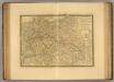
[XIII], uit: Geognostische Karte des Oesterreichischen Kaiserstaates mit einem grossen Theile Deutschland's u. Italien / hauptsachlich nach ... Haidinger's geognostischer Karte dieses Staates bearb. von Josef Scheda
1 : 3000000 titelvariant: General-Karte von Europa in 25 Blättern; Annotatie: Bijlage bij: General-Karte von Europa in 25 Blättern. - 1:2.592.000. - 1845-1847 Scheda, Joseph Wien : K.K. Militär. Geografisch. Institut
Prussia.
1 : 2600000 Mitchell, Samuel Augustus
Prussia.
1 : 2600000 Mitchell, Samuel Augustus
Střední Evropa
1 : 3000000 Evropa střední Kuchař, Karel V. Neubert a synové
Velkoněmecká Říše

[Deutschland]
Historisch-genealogisch-geographischer Atlas von Le Sage Las Cases, Emmanuel Auguste Dieudonné Marius Joseph de Johann Velten, Kunsthändler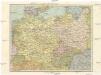
Střední Evropa
1 : 4500000 Evropa střední
Střední Evropa
1 : 4500000 Evropa střední
Germany
1 : 4200000 Německo
Germany, Austria, and Switzerland.
1 : 4092000 Gray, Frank Arnold
Allemagne, Pologne, Tchecoslovaquie.
1 : 2500000 Vivien St Martin, L.
Germany general map.
1 : 4300000 Society for the Diffusion of Useful Knowledge (Great Britain)
Germany.
1 : 6336000 Finley, Anthony
Germany.
1 : 6336000 Lucas, Fielding Jr.
Die Ältesten Karten von Deutschland

Übersichtskarte der Eisenbahnen und Eisen-Bahn-Abstoss-Stationen von Mitteleuropa 1883
Evropa střední W. Koch
Germany
A new general atlas of modern geography, consisting of a complete collection of maps of the four quarters of the globe Wyld, James James Wyld
Germany, Austria.
1 : 4118400 Letts, Son & Co.
Die hist. Entwicklung von Brandenburg-Preussen seit 1415
Mitteleuropa, Preußen, Expansion
Sbírka map a diagramů použitých na mírových konferencích v Paříži v letech 1919 - 1920

Autriche, Prusse, Confed. Germanique, Pologne 1788 a 1841.
1 : 6300000 Houze, Antoine Philippe
Letecká navigační mapa

Allgemeine Postkarte von der Preussischen Monarchie zur Uebersicht. No. 36= Prospectus cursuum veredariorvm, qvi omnibus partibus monarchiæ Borussiæ reperiuntur
Europe Centrale.
1 : 3500000 Picquet, C.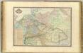
Europe Centrale.
1 : 3000000 Garnier, F. A., 1803-1863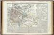
Carta generale della Germania ossia Confederazione Germanica.
1 : 3500000 Marzolla, Benedetto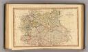
Central states Europe.
1 : 9000000 Fenner, Rest.
Rand McNally Popular map of Germany and Hungary
1 : 3992000 Rand McNally & Company
Der Deutsche Bund samt der Helvetischen Eidgenossenschaft aft. 1828
Historisch-genealogisch-geographischer Atlas von Le Sage Las Cases, Emmanuel Auguste Dieudonné Marius Joseph de Johann Velten, Kunsthändler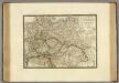
![[XIII], uit: Geognostische Karte des Oesterreichischen Kaiserstaates mit einem grossen Theile Deutschland's u. Italien / hauptsachlich nach ... Haidinger's geognostischer Karte dieses Staates bearb. von Josef Scheda](https://images-2.georeferencer.com/images/iiif/091021845365/full/,300/0/native.jpg)

