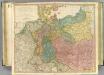
Maps of Germany

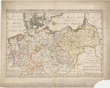
Allgemeine Postkarte von der Preussischen Monarchie zur Uebersicht. No. 36= Prospectus cursuum veredariorvm, qvi omnibus partibus monarchiæ Borussiæ reperiuntur
Germania magna
1 : 2280000 Evropa severozápadní Reichard, Christian Gottlieb Campius, D. a D. Campio
Das alte Germanien oder Tevtschland
Evropa střední
Das neue politische Gesicht Mitteleuropas
1 : 2000000 Evropa střední Velhagen & Klafing
Das neue politische Gesicht Mitteleuropas
1 : 2000000 Evropa střední Velhagen & Klafing
Das neue politische Gesicht Mitteleuropas
1 : 2000000 Evropa střední Velhagen & Klafing
Germaniae Antiquae
1 : 5100000 Mollova mapová sbírka Weigel, Christoph Weigel, Christoph I.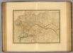
Empire d'Allemagne, Hongrie, Gallicie, Prusse, Provinces-Unies de Pays-Bas en 1789.
1 : 3500000 Picquet, C.
Sprachkarte von Deutschland
1 : 3000000 Evropa střední Bernhardt, Karl Bohné, J. J. von J.J. Bohné
Große Sprachenkarte von Mitteleuropa
1 : 2000000 Lange, Friedrich Reimer
Tabula Europae IIII. [Karte], in: Geographia universalis vetus et nova complectens Claudii Ptolemaei Alexandrini enarrationis libros VIII, S. 231.
1 Karte aus Atlas Münster, Sebastian [und Ptolemaeus, Claudius]
Tabula Europae IIII. [Karte], in: Claud. Ptolemaeus. Geographia lat. cum mappis [...], S. 263.
1 Karte aus Atlas Münster, Sebastian [und Ptolemaeus, Claudius]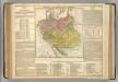
German Empire.
1 : 6200000 Lavoisne, M.
Regenkarte, Mittlere Jahrestemperatur v. Deutschland.
1 : 7000000 Andree, Richard
Sprachenkarte, Religionskarte v. Deutschland.
1 : 7000000 Andree, Richard
Hohenschichtenkarte, Bevolkerungsdichtigkeit.
1 : 7000000 Andree, Richard
Germanie Ancienne.
1 : 5300000 Monin, C.V.
Prussia - Holland and the German States.
1 : 3380000 Sharpe, J.
Map of the Empire of Germany.
1 : 1250000 Delarochette, Louis Stanislas d'Arcy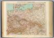
51-52. Germania, Polonia, Cecoslovacchia, Austria, Ungheria.
1 : 3000000 Touring club italiano
Politisch-statistische Charte von Deutschland nebst dem grössten Theile von Pohlen, einem grossen Theile von Frankreich und Nord-Italien
1 : 2900000 Evropa střední Champion, J. N. Baumann, J. Mitzky & Comp.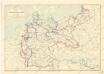
Karte der deutschen Wasser Wasserstrassen
Reise-, Post- und Zoll-Karte von Deutschland
1 : 2220000 Německo Hoffmann, Karl Friedrich Vollrath Erno, E. Carl Hoffmann
Die Ältesten Karten von Deutschland

Composite: Germany.
1 : 1250000 Robert Laurie & James Whittle
The Germany 21
1 : 2700000 Appleton, D. & Co.
Mapa teatru wojny na morzu i na lądzie
1 : 3000000 Belgie Scheda, Joseph von Steinhauser, Anton Artaria
Germanien
Evropa střední Wilhelm, August Bened. Halle, Chr. im Verlage des Geograph. Instituts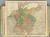
German Empire.
1 : 2150000 Faden, William, 1750?-1836