Maps of Poland

Allemagne orientale.
1 : 2000000 Andriveau-Goujon, J.
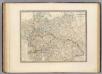
Karpathenlaender, Polen und Preussen
E. von Sydow's Schul-Atlas in sechs und dreissig Karten Sydow, Emil von bei Justus Perthes
Preussen, Polen, Galizen, Ungarn, Siebenbuergen
Ostmitteleuropa
Preussen, Polen, Galizien, Ungarn, Siebenbürgen
Schul-Atlas über alle Theile der Erde nach dem neuesten Zustande, und über das Weltgebäude Stieler, Adolf bei Justus Perthes
Polsko, Československo, Maďarsko a Rumunsko

Europe orientale
1 : 2000000 Bruxelles : De Rouck
Atlas Niox ; Atlas Niox. No. 31, Populations de l'Europe centrale. No. 31 bis, Populations de la péninsule des Balkans
1 : 6000000 Niox, Gustave-Léon 1840-1921 Paris : Ch. Delagrave
Karpathenländer, Polen und Preussen
Ostmitteleuropa Skizzenbuch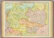
Central European states - political.
1 : 3000000 John Bartholomew and Son
Der östliche Kriegsschauplatz aus der Vogelschau
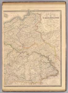
L'Allemagne, l'Europe centrale.
1 : 3460000 Andriveau-Goujon, J.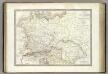
Germanie Ancienne.
1 : 3300000 Lapie, M. (Pierre), 1779-1850
Sbírka map a diagramů použitých na mírových konferencích v Paříži v letech 1919 - 1920

[Polen, Galizien, Ungarn, Kroatien u. Siebenbürgen; Moldau und Walachey]
Schul-Atlas über alle Theile der Erde nach dem neuesten Zustande, und über das Weltgebäude Stieler, Adolf Justus Perthes
REGNUM POLONIAE ejusque confinia
1 : 10700000 Evropa východní
Regni Poloniae, Magni Ducatus Lithuaniae Coeterarumq[ue] Regi Poloniae Subditarum Regionum Tabula
1 : 3100000 Allard, Carel
Germany, Austria, and Switzerland.
1 : 4092000 Gray, Frank Arnold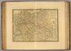
Europe Centrale.
1 : 3500000 Picquet, C.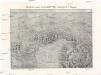
Plastická mapa východních Alp rakouských a Karpat
Alpy rakouské-oblast Emil Šolc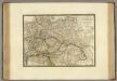
Empire d'Autriche, Monarchie Prussienne, Confederation Germanique, Pologne.
1 : 3500000 Brue, Adrien Hubert, 1786-1832
Europe Centrale.
1 : 4100000 Montemont, A.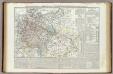
Carta generale della Germania ossia Confederazione Germanica.
1 : 3500000 Marzolla, Benedetto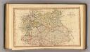
Central states Europe.
1 : 9000000 Fenner, Rest.
Oorlogskaart van Polen : bijzonder geschikt voor het volgen van de internationale gebeurtenissen / [cartografie] W. Seghers
1 : 1111000 W. Seghers Antwerpen : Patria ; [etc.]
Regni Poloniae magnique ducatusq. Lithuaniae nova et exacta tabula
1 : 3130000 Bělorusko Homann, Johann Baptist Starowolski, Szymon Homannovi dědicové
REGNI POLONIAE MAGNIQUE DUCATUS LITHUANIAE Nova et exacta tabula
1 : 3200000 Bělorusko Homann, Johann Baptist Starowolski, Szymon Homannovi dědicové
Regni Poloniae magnique ducatusq. Lithuaniae nova et exacta tabula
1 : 3130000 Bělorusko Homann, Johann Baptist Starowolski, Szymon Homann Erben
Regni Poloniae magnique ducat[us] Lithuaniae nova et exacta tabula
1 : 3041000 Bělorusko Homann, Johann Baptist Starowolski, Szymon â Iohanne Bapt. Homanno
Střední Evropa
1 : 3000000 Evropa střední Kuchař, Karel V. Neubert a synové