Maps of Poland

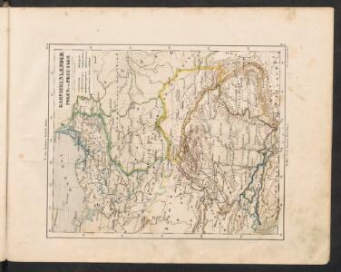
Karpathenlaender, Polen und Preussen
E. von Sydow's Schul-Atlas in sechs und dreissig Karten Sydow, Emil von bei Justus Perthes
Karpathenländer, Polen und Preussen
Ostmitteleuropa Skizzenbuch
Polsko, Československo, Maďarsko a Rumunsko

Allemagne orientale.
1 : 2000000 Andriveau-Goujon, J.
Atlas Niox ; Atlas Niox. No. 31, Populations de l'Europe centrale. No. 31 bis, Populations de la péninsule des Balkans
1 : 6000000 Niox, Gustave-Léon 1840-1921 Paris : Ch. Delagrave
Sbírka map a diagramů použitých na mírových konferencích v Paříži v letech 1919 - 1920
Europe Centrale.
1 : 3500000 Picquet, C.
Central European states - political.
1 : 3000000 John Bartholomew and Son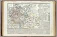
Carta generale della Germania ossia Confederazione Germanica.
1 : 3500000 Marzolla, Benedetto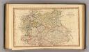
Central states Europe.
1 : 9000000 Fenner, Rest.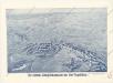
Der östliche Kriegsschauplatz aus der Vogelschau
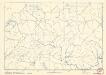
Soubor němých map pro střední školy
L'Allemagne, l'Europe centrale.
1 : 3460000 Andriveau-Goujon, J.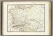
Germanie Ancienne.
1 : 3300000 Lapie, M. (Pierre), 1779-1850
Germany, Austria, and Switzerland.
1 : 4092000 Gray, Frank Arnold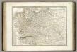
Allemagne.
1 : 3300000 Lapie, M. (Pierre), 1779-1850
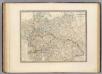
Preussen, Polen, Galizen, Ungarn, Siebenbuergen
Ostmitteleuropa
[Deutschland]
Historisch-genealogisch-geographischer Atlas von Le Sage Las Cases, Emmanuel Auguste Dieudonné Marius Joseph de Johann Velten, Kunsthändler
Germany
A new general atlas of modern geography, consisting of a complete collection of maps of the four quarters of the globe Wyld, James James Wyld
Eastern Germany, distribution of population.
1 : 2400000 Covers Poland, East Prussia, and border areas of Germany and Czechoslovakia. "From: Atlas des deutschen Lebensraumes in Mitteleuropa, plate 27. Data as of 1930-1934." "No. A-6287." United States. Office of Strategic Services. Research and Analysis Branch. [Washington, D.C.] : R & A, OSS
Preussen, Polen, Galizien, Ungarn, Siebenbürgen
Schul-Atlas über alle Theile der Erde nach dem neuesten Zustande, und über das Weltgebäude Stieler, Adolf bei Justus Perthes
Oorlogskaart van Polen : bijzonder geschikt voor het volgen van de internationale gebeurtenissen / [cartografie] W. Seghers
1 : 1111000 W. Seghers Antwerpen : Patria ; [etc.]
Europe Centrale.
1 : 4100000 Montemont, A.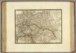
Empire d'Autriche, Monarchie Prussienne, Confederation Germanique, Pologne.
1 : 3500000 Brue, Adrien Hubert, 1786-1832
Germany general map.
1 : 4300000 Society for the Diffusion of Useful Knowledge (Great Britain)
Germany.
1 : 6336000 Finley, Anthony
Germany.
1 : 6336000 Lucas, Fielding Jr.
Europe orientale
1 : 2000000 Bruxelles : De Rouck
Der Deutsche Bund samt der Helvetischen Eidgenossenschaft aft. 1828
Historisch-genealogisch-geographischer Atlas von Le Sage Las Cases, Emmanuel Auguste Dieudonné Marius Joseph de Johann Velten, Kunsthändler