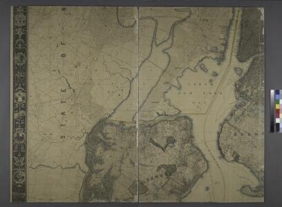
Maps of Hudson County
General map of the city of New York, consisting of boroughs of Manhattan, Brooklyn, Bronx, Queens and Richmond : consolidated into one municipality by act of the legislature of the state of New York (Chapter 378 of the laws of 1897) : showing in addition
from Whole
Map of New-York Bay and Harbor and the environs / founded upon a trigonometrical survey under the direction of F. R. Hassler, superintendent of the Survey of the Coast of the United States ; triangulation by James Ferguson and Edmund Blunt, assistants ;
from New York harbor
City of New Manhattan : proposed May 1911, revised May 1930 / T. Kennard Thomson, consulting engineer, New York City.
from Manhattan
Hammond's complete map of Staten Island, N.Y., Borough of Richmond, New York City.
From Staten Island
Map of property situated in the 12th ward of the city of New York belonging to the estate of John Taylor : to be sold at auction by Jas. Bleecker & Sons at the Merchts. Exchange at 12 o'clock on Tuesday the 1st April 1834.
from Manhattan
Outline & Index Map of The Borough of Richmond (Staten Island); Explanation; Note.
from Atlas of the city of New York, borough of Richmond, Staten Island. From actual surveys and original plans, by George W. and Walter S. Bromley.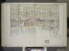
Brooklyn, Vol. 2, Double Page Plate No. 27; Part of Wards 30 & 31, Section 19; [Map bounded by 86th St., 23rd Ave., 24th Ave.; Including Gravesend Bay, 17th Ave.] / by and under the direction of Hugo Ullitz.
From Volume 2.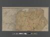
New Standard Map of the Borough of Richmond.
From Staten Island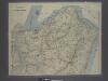
New map of Staten Island
from Staten Island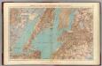
Brooklyn, N.Y. Bay, Jersey City, Hoboken, Bayonne, Newark Bay.
1 : 31680 Vermeule, C. C. (Cornelius Clarkson), 1858-1950
Newark, Elizabeth, the Oranges.
1 : 31680 Vermeule, C. C. (Cornelius Clarkson), 1858-1950
[Four maps showing the distribution of the population by nationality of mothers.]
From Manhattan
King's bird's-eye view of Brooklyn
From Brooklyn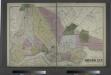
The City of Brooklyn.
from Atlas of Long Island, New York. From recent and actual surveys and records.
Elizabeth
1 : 24000
Elizabeth
1 : 24000
Elizabeth
1 : 24000
Elizabeth
1 : 24000
Jersey City
1 : 24000
Jersey City
1 : 24000
Elizabeth
1 : 24000
Elizabeth
1 : 24000
Jersey City
1 : 24000
Jersey City
1 : 24000
Elizabeth
1 : 24000
Elizabeth
1 : 24000
Jersey City
1 : 24000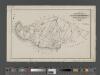
Map of the Village of New Brighton, Richmond Co., New York City, NY.
From Staten Island
South Brooklyn, Park Slope, Brooklyn heights, Cobble Hill, Boerum Hill, Carroll Gardens, Red Hook, Gowanus, Windsor Terrace. (cont.)
From District 6