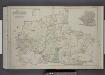
Maps of Richmond County
New map of Staten Island
from Staten Island
Outline & Index Map of The Borough of Richmond (Staten Island); Explanation; Note.
from Atlas of the city of New York, borough of Richmond, Staten Island. From actual surveys and original plans, by George W. and Walter S. Bromley.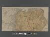
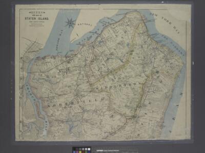
New Standard Map of the Borough of Richmond.
From Staten Island
Richmond Co., Staten Island.
1 : 31680 Vermeule, C. C. (Cornelius Clarkson), 1858-1950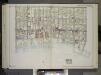
Brooklyn, Vol. 2, Double Page Plate No. 27; Part of Wards 30 & 31, Section 19; [Map bounded by 86th St., 23rd Ave., 24th Ave.; Including Gravesend Bay, 17th Ave.] / by and under the direction of Hugo Ullitz.
From Volume 2.
Map of the Village of New Brighton, Richmond Co., New York City, NY.
From Staten Island
Map of Staten Island o Richmond County. 16 views of buildings on border. Also view of Elliottville the property of Dr. S. M. Elliott.
From Staten Island
Staten Island South.
1 : 253440 Dripps, Matthew
Arthur Kill
1 : 24000
Arthur Kill
1 : 24000
Arthur Kill
1 : 24000
Arthur Kill
1 : 24000
Arthur Kill
1 : 24000
Arthur Kill
1 : 24000
Arthur Kill
1 : 24000
The Narrows
1 : 24000
The Narrows
1 : 24000
The Narrows
1 : 24000
The Narrows
1 : 24000
The Narrows
1 : 24000
The Narrows
1 : 24000
The Narrows
1 : 24000
The Narrows
1 : 24000
The Narrows
1 : 24000
Map of the Marine Hospital ground, Staten Island / reduced from a survey, made by John Ewen, dated March 1845 by Daniel Ewen, city surveyor.
from Staten Island
Brighton Heights, Clifton, Fort Wadsworth, Fox Hills, Grymes hill, Livingston, New Brighton, Randall Manor, Rosebank, Shore Acres, St. George, Stapleton, Tompkinsville, Ward hill, West New Brighton. (cont.)
From District 2
General map of the borough of Richmond (Staten Island) in the city of New York : showing in addition to the existing topographical features of the borough a tentative and preliminary plan for a street system of the same.
from Staten Island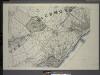
General map of the borough of Richmond (Staten Island) in the city of New York : showing in addition to the existing topographical features of the borough a tentative and preliminary plan for a street system of the same.
from Staten Island
Area District Map Section No. 26
from Area district map / City of New York, Board of Estimate and Apportionment.