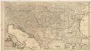
Maps of Carpathian Mountains

Le Royaume de Hongrie
1 : 2400000 Mollova mapová sbírka Valk, Gerhard Valck, Gerard
Hvngaria Magna In Regna et Prouincias diuisa
1 : 7400000 Mollova mapová sbírka
Totius Regni Hungariae et adjacentium regionum tabula
1 : 2200000 Dunaj-oblast Visscher, Nicolaes Jansz.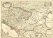
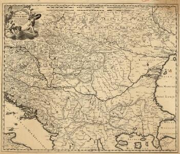
Le Royaume de Hongrie et les Estats qui en ont Esté sujets et qui font presentement la Partie Septentrionale de la Turquie en Europe.
1 : 2500000 Mollova mapová sbírka Sanson, Guillaume Cordier, Louis Jaillot, Alexis Hubert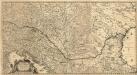
Totius Regni Hungariae
1 : 2200000 Mollova mapová sbírka Visscher, Nicolaes Jansz.
Artaria's Eisenbahn- u. Post- Communications-Karte v. Oesterreich-Ungarn
1 : 1700000 Rakousko-Uhersko Skrzeszewski, F. von Artaria & Comp.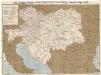
Artaria's Eisenbahn- u. Post- Communications-Karte v. Oesterreich-Ungarn
1 : 1700000 Rakousko-Uhersko Skrzeszewski, F. R. Artaria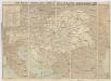
Artaria's Eisenbahn- u. Post-Communications-Karte v. Oesterreich-Ungarn
1 : 1700000 Budapešť-oblast (Maďarsko) Artaria
Artaria's Eisenbahn- u. Post-Communications-Karte v. Oesterreich-Ungarn
1 : 1700000 Budapešť (Maďarsko) Artaria
Der Donauraum
1 : 1500000 Dunaj-oblast Justus Perthes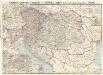
Artaria's Eisenbahn- u. Postkarte von Oesterreich-Ungarn
1 : 1500000 Budapešť (Maďarsko) Artaria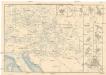
Eisenbahn-Routen-Karte für Österreich-Ungarn
Bratislava (Slovensko) Ritter, J. R. v. Waldheim
Eisenbahn-Routen-Karte für Österreich-Ungarn
Rakousko-Uhersko Ritter, J. R. v. Waldheim
90-91. Danube Countries. The World Atlas.
1 : 2500000 USSR (Union of Soviet Socialist Republics).
Nova et Accurata Regni Hungariae Tabula, ad Usum Serenissimi Burgundiae Ducis
1 : 2900000 Mollova mapová sbírka Jaillot, Alexis-Hubert Ottens, Josua
Nova et Accurata Tabula Regnorum Sup. et Inf. Hungariae
1 : 2500000 Mollova mapová sbírka Bodenehr, Gabriel Bodenehr, Gabriel
Mapa Rakousko-Uherského mocnářství a pohraničních států
1 : 4000000 Rakousko-Uhersko Rothaug, Jan Jiří Bečka, Karel Kartogr. ústav G. Freytaga & Berndta
Karpatenländer, Flusz- & Gebirgskarte
1 : 6000000 Donau-Karpaten-Gebiet
Karpaten-Länder
Donau-Karpaten-Gebiet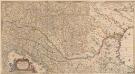
Totius Regni Hungariae, Maximaeque Partis Danubii Fluminis, una cum adjacentibus et finitimis Regionibus Novissima Delineatio [Karte], in: Novus atlas absolutissimus, Bd. 2, S. 293.
1 Karte aus Atlas Janssonius Offizin
Le Royaume de Hongrie...


Karpatenländer, politische Übersicht
1 : 6000000 Donau-Karpaten-Gebiet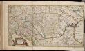
Totius Regni Hungariae maximaeque partis Danubii fluminis, una cum adjacentibus et finitimis regionibus novissima delineatio / per Nicolaum Visscher
1 : 2000000 Annotatie: Origineel is Blad 130 in atlas factice; Annotatie geografische gegevens: Met 2 schaalstokken Nicolaes Jansz. Visscher jr. 1649-1702 [Amsterdam : per Nicolaum Visscher]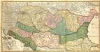
Novissima et Accuratissima totius Regni Hungariae, Dalmatiae, Croatiae, Sclavoniae, Bosniae, Serviae, Transylvaniae, cum Adiacentibus Regnis et Provinciis Tabula
1 : 2100000 Mollova mapová sbírka Sandrart, Jakob von Sandrart, Jacob von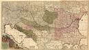
Regni Hungariae et Regionum
1 : 2100000 Mollova mapová sbírka Wit, Frederik de Covens, Johannes I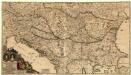
Augustissimi et Invictissimi Romanorum Imperatoris Caroli VI. Haereditarium Regnum Hungaria
1 : 4000000 Mollova mapová sbírka Sedelmayer, Johann Paul Heckenauer, Jakob Wilhelm Sedlmayr, Johann Paul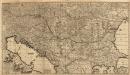
Regni Hungariae et Regionum
1 : 2100000 Mollova mapová sbírka Wit, Frederik de Wit, Frederick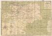
Eisenbahn-Karte der oesterreichisch-ungarischen Monarchie
1 : 1228000 Budapešť (Maďarsko : oblast) Beer, Josef A. Hartleben