Maps of Northern European Plain

Europäisches Russland
Russland / Europäischer Teil Skizzenbuch
Europaeisches Russland mit Kasan, Astrachan und Georgien
Russland / Europäischer Teil
Russland
1 : 15000000 Russland / Europäischer Teil
La Russie d'Europe
Russland Bielaerts, J. B.
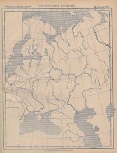
Europäisches Russland
1 : 20500000 Russland / Europäischer Teil
Karte der Vergrösserungen Russlands unter Peter dem Grossen und seinen Nachfolgern
Russland Peter I.
Europaeisches Russland mit Kasan, Astrachan und Georgien
Schul-Atlas über alle Theile der Erde nach dem neuesten Zustande, und über das Weltgebäude Stieler, Adolf bei Justus Perthes
Karte der Vergrösserungen Russlands unter Peter dem Grossen und seinen Nachfolgern
Russland Peter I.
Europäisches Russland
1 : 14500000 Russland / Europäischer Teil
Ruszland
1 : 18000000 Russland / Europäischer Teil
Des Russischen Reichs Europäischer Theil
Stieler's Hand-Atlas Stieler, Adolf bei Justus Perthes
Russland
Russland / Europäischer Teil Skizzenbuch
Das europäische Rusland
Russland
Russland
Russland / Europäischer Teil
Russia.
1 : 7760000 Johnson, A.J.
Russia.
1 : 7760000 Johnson, A.J.
Ravensteinkarte Osteuropa
1 : 3333333 Evropa střední a východní Ravensteins Geographische-Verlagsanstalt und Druckerei
Russisches Reich. Verwaltungsgrenzen von 1914. Europäischer Teil
Russland / Europäischer Teil Verwaltungsgliederung
TABVLA | RVSSIÆ | ex autographo, quod delineandum | curavit Foedor filius Tzaris Boris desum- | ta; et ad fluvios Dwinam, Zuchanam, aliaque | loca, quantum ex tabulis ex notitiis ad nos dela- | tis fieri potuit, amplificata...
Amstelodami, | Excusum Apud Guiljelmum Blaeu
Europäisches Russland
1 : 14500000 Russland / Europäischer Teil
E. Russland
Rusko západní
Wirtschaftskarten I. Rußland
1 : 18000000 Russland / Europäischer Teil Wirtschaft
Europäisches Russland
1 : 13300000 Russland / Europäischer Teil
Europäisches Russland
1 : 16000000 Russland / Europäischer Teil
Karte der Bevölkerung Russlands im 9. Jahrhundert
Russland Bevölkerungsdichte
Ost Europa
1 : 12500000 Russland / Europäischer Teil
Europaeisches Russland mit Polen
Geographischer Atlas über alle Theile der Erde Ziegler, Jakob Melchior Verlag von Joh. Wurster um Comp.
Russland
1 : 15225000 Russland / Europäischer Teil
Europaeisches Russland mit Polen
Geographischer Atlas über alle Theile der Erde Ziegler, Jakob Melchior Verlag von Dietrich Reimer