Maps of Masovian Voivodeship
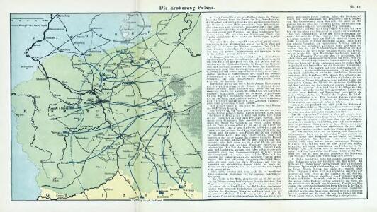
Nr. 12. Die Eroberung Polens
Polen Weltkrieg <1914-1918>, Eroberung
Karte von Pohlen und den Umgebungen Warschaus
1 : 2000000 Polsko Seidler, C. C. Hennig
Karte von Pohlen und den Umgebungen Warschaus
1 : 2000000 Polsko Seidler, C. C. Hennig
Poland. Polska.
1 : 1760000 Society for the Diffusion of Useful Knowledge (Great Britain)
Poland.
1 : 1774080 Letts, Son & Co.
Königreich Polen

[Neuer Atlas der ganzen Erde nach den neuesten Bestimmungen ... : XXI.] Das Königreich Polen und der Freistaat Krakau
Entworfen und gezeichnet von Dr. F.W. Streit Leipzig : J.C. Hinrichs'sche Buchhandlung
Chelm und Podlachien
Polen Chełm (Województwo) Podlachien Auner, H.
Karte von Pohlen und den Umgebungen Warschaus
1 : 1950000 Polsko Hennig, C. C. Hennig
Karte von Pohlen und den Umgebungen Warschaus
1 : 1950000 Polsko Hennig, C. bei Bohmanns Erben
Karte von Pohlen und den Umgebungen Warschaus
1 : 1950000 Polsko Hennig, C. C. Hennig
Polen.
1 : 1200000 Stein, Christ. Gottfr. Dan.
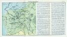
Preussen, Posen, Polen, Krakau.
1 : 5500000 Brudin, J. L.; Stieler, Adolf
Der Kriegsschauplatz in Polen
1 : 600000 Polsko Kettler, Julius Iwan Carl Flemming
Provinz Preussen und Polen
1 : 2650000 Ostpreußen, Westpreußen

Erste Offensive in Polen
1 : 4000000 Polen Feldzug, Weltkrieg <1914-1918>
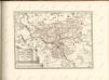
Polonia Propria
1 : 1400000 Mollova mapová sbírka Homann, Johann Baptist Homann, Johann Baptista - dědici
Polonia Regnum, et Silesia Ducatus
1 : 1600000 Mollova mapová sbírka Blaeu, Willem Janszoon Bleau, Willem Janszon
TABULA NOVA POLONIAE et SILESIAE
1 : 1800000 Gdaňsk (Polsko) Goos, Abraham impreßa in aedibus Nicolaij Iohannis Vißcher
Théatre de la guerre actuelle, en Allemagne, en Pologne et en Turquie. n4, Cracovie, Warsovie et Breslau
1 : 900000 Chanlaire, Pierre Grégoire 1758-1817 Paris : chez l'auteur P. G. Chanlaire
[Polen]
1 : 800000 Polsko S. Hirzel
Herzogthum Warschau
1 : 2310000 Varšava (Polsko : oblast)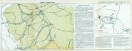
Nr. 13. Einfälle in Russisch-Polen
Polen Weltkrieg <1914-1918>
West-Galizien
1 : 850000 Halič (Polsko a Ukrajina) Metzburg, Georg Ignaz von Junker, Ch. T. Mollo und Comp.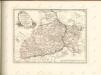

General-Carte von Westgallizien
1 : 291000 Polsko jihovýchodní Benedicti, Lucas