Maps of Germany

Brünn 119, uit: Special-Karte von Mittel-Europa / nach amtlichen Quellen bearbeitet von W. Liebenow
1 : 300000 titelvariant: W. Liebenow's Mittel-Europa; Annotatie: Titel boven de bladen: W. Liebenow's Mittel-Europa Johannes Wilhelm Liebenow 1822-1897 Frankfurt a. M. : Ludwig Ravenstein
Atlas d'industrie de la république tchécoslovaque
Central Europe. Pergamon World Atlas.
1 : 2500000 Polish Army Topography Service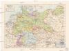
Německá říše
1 : 3250000 Evropa střední Státní nakladatelství
Germany (south)
1 : 1250000 Kitchin, Thomas
Kleine geologische Karte von Deutschland / bearb. von W. Schriel ; hrsg. von der Preussischen Geologischen Landesanstalt
1 : 2000000 Annotatie: Bijbehorend materiaal (Erläuterungen. - Ibid., 1930. - 28 p. : ill. ; 21 cm + krt) apart opgeborgen in legendakast Schriel, Walter; Preussische Geologische Landesanstalt Berlin : Preussische Geologische Landesanstalt
Nova Totius Germaniae descriptio Teutschland
1 : 4300000 Mollova mapová sbírka Merian, Matthäus Merian, Matthäus - dědici
Prussia, German States.
1 : 4400000 Mitchell, Samuel Augustus
Prussia, German States.
1 : 4400000 Mitchell, Samuel Augustus
Prussia, German States.
1 : 4400000 Mitchell, Samuel Augustus Jr.
Prussia, German States.
1 : 4400000 Mitchell, Samuel Augustus
Prussia, German States.
1 : 4400000 Mitchell, Samuel Augustus
Prussia, And The German States.
1 : 4400000 Mitchell, Samuel Augustus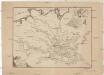
Ideal Postcharte von Boehmen
Evropa střední Berka, Jan Wenzel Schwarz
Ideal Postcharte von Boehmen
Evropa střední Berka, Jan Wenzel Schwarz
Extract einer General-Post-Chartre von allen Pos routen durch gantz Teutschland und dessen gewöhnliche X. Creisse in benachbarte Länder
1 : 5800000 Mollova mapová sbírka Weigel, Christoph Weigel, Christoph I.
Germaniae Antiqvae Popvli
1 : 10750000 Mollova mapová sbírka Clüver, Philipp Fuhrmann, Mathias
Základ zkázy nezvratné
1 : 5000000 Morava (Česko) Kuffner, Hanuš
Obec českého národa
1 : 3400000 Evropa střední Kuffner, Hanuš
Reise und Influenz-Karte der Eil- Post- und Brancard-Wagen-Course in dem Oesterreichischen Kaiserstaate
Evropa střední Raffelsperger, Franz Bermann, J. Franz Raffelsperger
Reise und Influenz-Karte der Eil- Post- und Brancard-Wagen-Course in dem Oesterreichischen Kaiserstaate
Evropa střední Raffelsperger, Franz Haupt-Direction der k. k. Fahrposten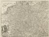
Carte von Ober u. Nieder Teutschland
1 : 4500000 Mollova mapová sbírka Vogel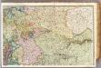
France 2.
1 : 1170000 Brue, Adrien Hubert, 1786-1832; Herisson, Eustache, b. 1759
Vývoj Státu československého
1 : 2800000 Česko Hocke, Jan B. Kočí
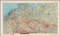
Germany : International frontiers 1937 : internal boundaries 1944
1 : 1600000 [London] : [War Office]
Strassenzustandskarte von Deutschland

Der Festungskrieg zu Ende des 17. Jahrhunderts
Ath (Belgie) K.k. Generalstabes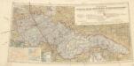
Přehledná letecká mapa Republiky československé: Carte aéronautique d'ensemble de la République Tchécoslovaque
Vojenský zeměpisný ústav
Tchéco-Slovaquie
1 : 1000000 Československo Fond établi per le Service Géographique Britannique


