Maps of Germany
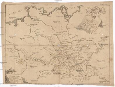
Ideal Postcharte von Boehmen
Evropa střední Berka, Jan Wenzel Schwarz
Ideal Postcharte von Boehmen
Evropa střední Berka, Jan Wenzel Schwarz
Allemagne, Pologne, Tchecoslovaquie.
1 : 2500000 Vivien St Martin, L.
Central Europe. Pergamon World Atlas.
1 : 2500000 Polish Army Topography Service
Velkoněmecká říše, Protektorát Čechy a Morava, Gen.- Guvernement, Slovensko a Švýcarsko

Die hist. Entwicklung von Brandenburg-Preussen seit 1415
Mitteleuropa, Preußen, Expansion
Německá říše
1 : 3250000 Evropa střední Státní nakladatelství
Germany, Switzerland, Holland.
1 : 6500000 Peterson, Augusts
Die Haupt-Verkehrs-Richtungen auf deutschen Eisenbahnen hinsichtlich ihrer merkantilen Bedeutung durch Farben veranschaulicht
1 : 2000000 Loeben, W.K. von Weingartner
Germany : International frontiers 1937 : internal boundaries 1944
1 : 1600000 [London] : [War Office]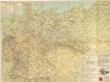
Strassenzustandskarte von Deutschland
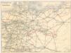
Eisenbahnverbindungen in Deutschland

Territoriale Entwickelung des Brandenburg-Preussischen Staates
Volksschul-Atlas über alle Teile der Erde Lange, Henry Druck und Verlag von Georg Westermann
Map showing expansion of Prussia into the German Empire
1 : 2000000 Map showing expansion of Prussia into the German Empire. War Office
Das allmälige Wachsthum des preussischen Staates. No. 43 Preussen beim Regierungsantritte Friedrich Wilhelm III. 1797
Preußen Friedrich Wilhelm III., Preußen, König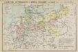
Geschichtl. Entwicklung d. Königr. Preussen vom Frieden von Tilsit (1807) bis jetzt
Deutschland
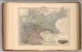
Prussia, German States.
1 : 4400000 Mitchell, Samuel Augustus
Prussia, German States.
1 : 4400000 Mitchell, Samuel Augustus
Prussia, German States.
1 : 4400000 Mitchell, Samuel Augustus Jr.
Prussia, German States.
1 : 4400000 Mitchell, Samuel Augustus
Prussia, German States.
1 : 4400000 Mitchell, Samuel Augustus
Prussia, And The German States.
1 : 4400000 Mitchell, Samuel Augustus
Eisenbahn- und Reise-Karte vom Deutschen Reiche
1 : 1750000 Německo E. Heckendorff's Verlag
Das allmälige Wachsthum des preussischen Staates. No. 44 Preussen in seiner gegenwärtigen Gestalt
Preußen
Rand McNally Popular map of Germany and Hungary
1 : 3992000 Rand McNally & Company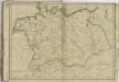
Allemagne.
1 : 3000000 Migeon, J.
Prussia - Holland and the German States.
1 : 3380000 Sharpe, J.
Schiffahrtsstraßen im Deutschen Reich 1903
Deutschland Wasserstraße, Binnenschifffahrt Kunz, Andreas ; Moeschl, Joachim Robert