Maps of Kostanay Region

[X], uit: Geognostische Karte des Oesterreichischen Kaiserstaates mit einem grossen Theile Deutschland's u. Italien / hauptsachlich nach ... Haidinger's geognostischer Karte dieses Staates bearb. von Josef Scheda
1 : 3000000 titelvariant: General-Karte von Europa in 25 Blättern; Annotatie: Bijlage bij: General-Karte von Europa in 25 Blättern. - 1:2.592.000. - 1845-1847 Scheda, Joseph Wien : K.K. Militär. Geografisch. Institut
Geologičeskaja karta Evropejskoj Rossii
1 : 2500000 Ostblatt Karpinskij, A.P. (Aleksandr Petrovič) Kartografičeskoe zavedenie A.Il'ina
Friedensdislokation im europäischen Russland
1 : 2800000 Rusko západní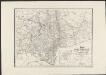
Karte vom Ural Gebirge, gegründet auf die astronomischen Beobachtungen von Wischnewsky, Schubert, A. v. Humboldt, Ad. Erman, und auf handschriftliche Specialkarten
1 : 2000000 [S.l.] : [s.n.]
Russia 7.
1 : 5068800 Letts, Son & Co.
Russia in Europe Part VII.
1 : 4300000 Society for the Diffusion of Useful Knowledge (Great Britain)
Schema historických momentů československ. vojenských operací na Sibiři 1918-1919
Karte vom URAL GEBIRGE
1 : 2000000 Ural (Rusko : oblast) Berghaus, Heinrich Karl Wilhelm Erman, Ad. Justus Perthes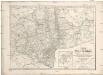
Karte vom Ural Gebirge
1 : 2000000 Ural-oblast (Rusko) Erman, Ad. bei Justus Perthes
24. Urals. The World Atlas.
1 : 3000000 USSR (Union of Soviet Socialist Republics).
Feuille 20 (F III), uit: Carte géologique internationale de l'Europe : la carte, votée au congrès géologique international de Bologne en 1881, est exécutée conformément aux décisions d'une commission internationale, avec le concours des gouvernements, sous le dir. de M.M. Beyrich et Hauchecorne
Annotatie: Blad 48 gamme des couleurs; blad 49: bladwijzer en titelblad Heinrich Ernst Beyrich 1815-1896; Wi. Hauchecorne Berlin : Reimer / (Berlin: Institut lithographique)
Partie, Russie d'Europe. Europe 11.
1 : 1641836 Vandermaelen, Philippe, 1795-1869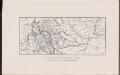
Map showing the country traversed by Yermak
Russland Sibirien Eroberung Ermak, Timofeevič
[Nižnjaja Volga]
Volha-oblast (Rusko)
Partie, Russie. Europe 17.
1 : 1641836 Vandermaelen, Philippe, 1795-1869
Nova Et Accurata Wolgae Fluminis, olim RHA dicti Delineatio [Karte, Teil 1], in: Novus atlas absolutissimus, Bd. 1, S. 87.
1 Karte aus Atlas Janssonius Offizin
Nova et accurata Wolgæ fluminis olim Rha dicti delineatio / auctore Adamo Oleario
1 : 1300000 1 Karte in 3 Teilen : Kupferdruck ; 48 x 57 cm Olearius, Adam [Verlag nicht ermittelbar]
Nova et accurata Wolgæ fluminis olim Rha dicti delineatio / auctore Adamo Oleario
1 : 1400000 1 Karte in 2 Teilen : Kupferdruck ; 47 x 55 cm Janssonius van Waesbergen, Johannes Janssonius-Waesbergius et Moses Pitt
NOVA & ACCVRATA | WOLGÆ FLVMINIS
olim RHA dicti, | DELINEATIO | Auctore | ADAMO OLEARIO. [Amsterdam : Joan Blaeu]
Karte der stroganowschen Erbländer
1 : 850000 Leipzig : Wilhelmi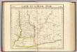
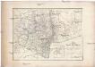
Partie, Russie d'Asie. Asie 21.
1 : 1641836 Vandermaelen, Philippe, 1795-1869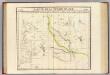
Partie, Russie d'Asie. Asie 29.
1 : 1641836 Vandermaelen, Philippe, 1795-1869
Bez titulu: Uržum a okolí

Obščaja geologičeskaja karta evropejskoj Rossii : List 92: Saratov - Penza
1 : 420000 sostavili I. Sintsov i S. Nikitin = Carte géologique générale de la Russie d'Europe : Feuille 92: Saratov - Pensa dressée par I. Sintzov et S. Nikitin [S.l.] : [s.n.]
Südlicher Theil des Saratowschen Gouvernements mit dem See Elton und den Salzstrassen
Russland, Saratow (Gouvernement), Verkehrswege
Mittlerer Theil des Saratowschen Gouvernements mit den deutschen Colonieen
Russland, Saratow (Gouvernement), Wolgadeutsche
Geologische Karte des Hüttenbezirks Katharinenburg
1 : 210000 Hofmann, E. Kartographische Anstalt A. Ilgin
Berg- und Wiesenufer von Saratow
1 : 2000000 Saratow
Geologische Karte des Hüttenbezirks Goroblagodatsk
1 : 210000 Hofmann, E. Kartographische Anstalt A. Ilgin
![[X], uit: Geognostische Karte des Oesterreichischen Kaiserstaates mit einem grossen Theile Deutschland's u. Italien / hauptsachlich nach ... Haidinger's geognostischer Karte dieses Staates bearb. von Josef Scheda](https://images-2.georeferencer.com/images/iiif/766532217034/full/,300/0/native.jpg)

