Maps of Bashkortostan

Maps of Bashkortostan

$title$

Karte vom Ural Gebirge, gegründet auf die astronomischen Beobachtungen von Wischnewsky, Schubert, A. v. Humboldt, Ad. Erman, und auf handschriftliche Specialkarten
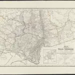
1 : 2000000 [S.l.] : [s.n.]
$title$

[X], uit: Geognostische Karte des Oesterreichischen Kaiserstaates mit einem grossen Theile Deutschland's u. Italien / hauptsachlich nach ... Haidinger's geognostischer Karte dieses Staates bearb. von Josef Scheda

1 : 3000000 titelvariant: General-Karte von Europa in 25 Blättern; Annotatie: Bijlage bij: General-Karte von Europa in 25 Blättern. - 1:2.592.000. - 1845-1847 Scheda, Joseph Wien : K.K. Militär. Geografisch. Institut
$title$

Karte vom URAL GEBIRGE

1 : 2000000 Ural (Rusko : oblast) Berghaus, Heinrich Karl Wilhelm Erman, Ad. Justus Perthes
$title$

Karte vom Ural Gebirge

1 : 2000000 Ural-oblast (Rusko) Erman, Ad. bei Justus Perthes
$title$

Schema historických momentů československ. vojenských operací na Sibiři 1918-1919

$title$

24. Urals. The World Atlas.

1 : 3000000 USSR (Union of Soviet Socialist Republics).
$title$

Feuille 14 (G II), uit: Carte géologique internationale de l'Europe : la carte, votée au congrès géologique international de Bologne en 1881, est exécutée conformément aux décisions d'une commission internationale, avec le concours des gouvernements, sous le dir. de M.M. Beyrich et Hauchecorne

Annotatie: Blad 48 gamme des couleurs; blad 49: bladwijzer en titelblad Heinrich Ernst Beyrich 1815-1896; Wi. Hauchecorne Berlin : Reimer / (Berlin: Institut lithographique)
$title$

Map showing the country traversed by Yermak

Russland Sibirien Eroberung Ermak, Timofeevič
$title$

Feuille 20 (F III), uit: Carte géologique internationale de l'Europe : la carte, votée au congrès géologique international de Bologne en 1881, est exécutée conformément aux décisions d'une commission internationale, avec le concours des gouvernements, sous le dir. de M.M. Beyrich et Hauchecorne

Annotatie: Blad 48 gamme des couleurs; blad 49: bladwijzer en titelblad Heinrich Ernst Beyrich 1815-1896; Wi. Hauchecorne Berlin : Reimer / (Berlin: Institut lithographique)
$title$

Partie, Russie d'Europe. Europe 11.

1 : 1641836 Vandermaelen, Philippe, 1795-1869
$title$

Partie, Russie d'Asie. Asie 21.

1 : 1641836 Vandermaelen, Philippe, 1795-1869
$title$

Karte der stroganowschen Erbländer

1 : 850000 Leipzig : Wilhelmi
$title$

NOVA & ACCVRATA | WOLGÆ FLVMINIS

olim RHA dicti, | DELINEATIO | Auctore | ADAMO OLEARIO. [Amsterdam : Joan Blaeu]
$title$

Bez titulu: Uržum a okolí

$title$

Geologische Karte des Hüttenbezirks Katharinenburg

1 : 210000 Hofmann, E. Kartographische Anstalt A. Ilgin
$title$

Geologische Karte des Hüttenbezirks Goroblagodatsk

1 : 210000 Hofmann, E. Kartographische Anstalt A. Ilgin
$title$

Geologische Karte des Hüttenbezirks Slatoust

1 : 210000 Hofmann, E. Kartographische Anstalt A. Ilgin
$title$

Geologische Karte des Hüttenbezirks Wotkinsk |i Geologische Karte des Hüttenbzirks Perm

1 : 210000 Hofmann, E. Kartographische Anstalt A. Ilgin
$title$

Bez titulu: Slobodskoj a okolí

$title$

Schema historických momentů československ. vojenských operací na Sibiři 1918-1919

$title$

Schema historických momentů československ. vojenských operací na Sibiři 1918-1919

$title$

Geologičeskaja karta Evropejskoj Rossii

1 : 2500000 Ostblatt Karpinskij, A.P. (Aleksandr Petrovič) Kartografičeskoe zavedenie A.Il'ina
$title$

Schema historických momentů československ. vojenských operací na Sibiři 1918-1919

$title$

Carte generale de toute l'Europe, 3

1 Blatt : 57 x 48 cm J.M. Will
$title$

Schema historických momentů československ. vojenských operací na Sibiři 1918-1919

$title$

Friedensdislokation im europäischen Russland

1 : 2800000 Rusko západní
$title$

(Europaischen Russland II).

1 : 5000000 Berghaus, Heinrich; Flemming, Carl; Handtke, Friedrich H.; Sohr, Karl
$title$

General'naja karta Orenbugskago kraja i častej Chivinskago i Bucharskago vlad"nij

1 : 2100000 Orenburg (Rusko : oblast) pri general'nom štabě orenburskago vojennago okruga
$title$

Russia 7.

1 : 5068800 Letts, Son & Co.
$title$

Russia in Europe Part VII.

1 : 4300000 Society for the Diffusion of Useful Knowledge (Great Britain)
© MapTiler © OpenStreetMap contributors
How does it work?
These instructions will show you how to find historical maps online.
Getting started
Type the place name in the search box to find the exact location. You can further adjust the search by zooming in and out.
Zoom
Zoom in and out with the buttons or use your mouse or touchpad natively.
Exact Area tool
Click here and draw a rectangle over the map to precisely define the search area.
Set filters
Narrow your search with advanced settings, such as Years (from/to), Fulltext, Publisher, etc.
Results
See the results of your search on the right side. You can scroll down to find more maps of this location.
?

Download OldMapsOnline Mobile