Maps of Europe

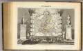
[Übersicht von Europa mit ethnograph. Begränzung der einzelnen Staaten, und den Völker-Sitzen in der Mitte des 19ten Jahrhunderts]
Zweiter Band, enthaltend in vier Abtheilungen die Vertheilung der Organismen: 5. Pflanzen-Geographie, 6. Thier-Geographie, 7. Anthropographie, 8. Ethnographie Humboldt, Alexander von Verlag von Justus Perthes
Europa
Schul-Atlas über alle Theile der Erde nach dem neuesten Zustande, und über das Weltgebäude Stieler, Adolf bei Justus Perthes
Europa mit politischer Begränzung der einzelnen Staaten
Hand-Atlas über alle Theile der Erde nach dem neuesten Zustande und über das Weltgebäude Stieler, Adolf bei Justus Perthes
Dated events, World War map, by Stanley Turner
1 : 13000000 Turner, Stanley
Nuove scoperte de'russi al nord del mare del Sud sí nell'Asia, che nell'America
1 Karte : Kupferdruck ; 30 x 39 cm Zatta presso Antonio Zatta
Letecká navigační mapa
Europe.
1 : 40000000 Levasseur, Victor.
State of Nations at the Christian aera From Pinkerton on the Goths.
1 : 40000000 Finley, Anthony
Europa
E. von Sydow's Schul-Atlas in sechs und dreissig Karten Sydow, Emil von bei Justus Perthes
Ubersicht von Europa; mit ethnograph.
1 : 19008000 Berghaus, Heinrich
Europa zur Uebersicht der Flussgebiete und Höhenzüge
Hand-Atlas über alle Theile der Erde nach dem neuesten Zustande und über das Weltgebäude Stieler, Adolf bei Justus Perthes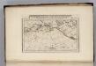
Discoveries made by Captains Cook & Clerke.
1 : 43000000 Carey, Mathew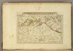
Map of the Discoveries made by Captn Cook & Clerke.
1 : 42000000 Carey, Mathew
Map of the Discoveries made by Capts. Cook & Clarke in the Years 1778 & 1779.
1 : 43000000 Carey, Mathew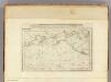
Map of the Discoveries made by Capts. Cook & Clerke.
1 : 43000000 Carey, Mathew
Map of the Discoveries made by Capts. Cook & Clerke.
1 : 43000000 Carey, Mathew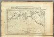
Map of the Discoveries made by Capts. Cook & Clerk.
1 : 30000000 Carey, Mathew
Europa
Schul-Atlas über alle Theile der Erde nach dem neuesten Zustande, und über das Weltgebäude Stieler, Adolf Justus Perthes
Europa
1 Karte : Kupferdruck ; 47 x 55 cm Walch Johann Walch
Europa
1 Karte : Kupferdruck ; 21 x 26 cm Reilly Franz J. J. von Reilly
[Verbreitung und Vertheilung der Europäischen Vögel]
Zweiter Band, enthaltend in vier Abtheilungen die Vertheilung der Organismen: 5. Pflanzen-Geographie, 6. Thier-Geographie, 7. Anthropographie, 8. Ethnographie Humboldt, Alexander von Verlag von Justus Perthes
E. Asia, W. North America.
1 : 41000000 Seaman, James V.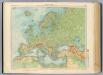
11-12. Europa fisica.
1 : 12000000 Touring club italiano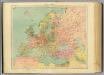
13-14. Europa politica.
1 : 12000000 Touring club italiano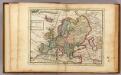
Europe.
1 : 29000000 Moll, Herman, d. 1732
Evropa
1 Karte : Kupferdruck ; 38 x 46 cm Mercator; Mercator; Hondius Henricus Hondius
Evropa
1 Karte : Kupferdruck ; 38 x 46 cm Mercator; Mercator; Hondius Henricus Hondius?
Evropa
1 Karte : Kupferdruck ; 38 x 46 cm Mercator; Mercator; Hondius Jodocus Hondius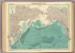
North Pacific Ocean.
1 : 25000000 John Bartholomew & Co.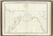
![[Übersicht von Europa mit ethnograph. Begränzung der einzelnen Staaten, und den Völker-Sitzen in der Mitte des 19ten Jahrhunderts]](https://images-2.georeferencer.com/images/iiif/508933710717/full/,300/0/native.jpg)

