Maps of Netherlands

Niederlande und Belgien
Neuer Handatlas über alle Theile der Erde Kiepert, Heinrich Verlag von Dietrich Reimer
Niederlande u. Belgien
[Allgemeiner Atlas über alle Theile der Erde in 29 Blättern] Ziegler, Jakob Melchior Top. Anstalt v. J. Wurster u. Comp.

Niederlande u. Belgien.
1 : 1050000 Stein, Christ. Gottfr. Dan.
Niederland und Belgien
Geographischer Atlas über alle Theile der Erde Ziegler, Jakob Melchior Verlag von Joh. Wurster um Comp.
Das Königreich Niederlande, das Königreich Belgien, und das Grossherzogthum Luxemburg
1 : 925000 Belgie Schmitfeldt, Georg Mollo, Tranquillo Tranquillo Mollo
Niederlande und Belgien
Geographischer Atlas über alle Theile der Erde Ziegler, Jakob Melchior Verlag von Dietrich Reimer
Novissima et accuratissima XVII Provinciarum Germaniae Inferioris Delineatio. [Karte], in: Novus atlas absolutissimus, Bd. 3, S. 22.
1 Karte aus Atlas Janssonius Offizin
[Historisch-geographischer Atlas zu den allgemeinen Geschichtswerken von C. v. Rotteck, Pölitz u. Becker] : Die Niederlande zur Uebersicht der Hauptbegebenheiten
von Julius Loewenberg Lithographie von B. Herder zu Freiburg im Breisgau [Freiburg im Breisgau] : [Herder]
Novissima et accuratissima XVII provinciarum Germaniae Inferioris delineatio / A. Deur sculpsit
1 : 900000 Annotatie: Oorspr. verschenen in: Atlas contractus ... - Amstelaedami : ex officina Nicolai Visscher, [1656-1677]; Origineel is Blad 34 in atlas factice; Annotatie geografische gegevens: West boven Deur, Abraham [Amsterdam : ex officina Nicolai Visscher]
Die Niederlande und Belgien
1 : 830000 Belgie Kiepert, Heinrich Eulenstein, F. Geographisches Institut

Niederlande und Belgien
Adolf Stieler's Handatlas über alle Theile der Erde und über das Weltgebäude Stieler, Adolf Justus Perthes
Holland and Belgium.
1 : 2080000 Tanner, Henry S.
Germaniae Inferioris XVII provinciarum accuratissima tabula / nuperrime edita per Nicolaum Visscher
1 : 950000 Annotatie: Met privilege; Met opdracht aan Theodorus Munter; Annotatie geografische gegevens: West boven Visscher, Nicolaes (1649-1702) [Amsterdam : N. Visscher]
Holland And Belgium.
1 : 1900800 Mitchell, Samuel Augustus
Belgium And Holland.
1 : 1520640 Burr, David H., 1803-1875
Netherlands.
1 : 3350000 Fenner, Rest.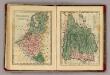
Netherlands, Belgium, Spain, Portugal.
Goodrich, S.G.
Netherlands.
1 : 1480000 Society for the Diffusion of Useful Knowledge (Great Britain)
Carte du Royaume des Pays-Bas, comprenant les routes de poste et relais depuis Paris jusqu'aux frontières septentrionales de la Hollande, avec un Itinéraire des communications de Strasbourg à Amsterdam et Hambourg
1 : 1280000 [par] Hocquart. Paris : Audin
[89][89] Novissima et accuratissima XVII Provinciarum Germaniae Inferioris tabula, uit: Atlas sive Descriptio terrarum orbis
Annotatie: Gedigitaliseerde versie. Amsterdam. Heiloo : Picturae (vervaardiger), 2015. tiff-bestand. Gedigitaliseerd: 07-01-2015; Origineel: Universiteitsbibliotheek Vrije Universiteit (XL.05127.-) ; Netherlands; Titelpagina ontbreekt Wit, Frederik de Amsterdam : Frederick de Wit
Kaart van de Nederlanden, Belgie, Luxemburg, Noordelijk Frankrijk en Westelijk Duitschland : ten gebruike van algemeene besturen, touristen, handelsreizigers, kantoren, instituten, enz. / vervaardigd ... onder toezicht en met medew. van J.A. van Voorthuijsen ; door A.A. en A.C. Nunnink
1 : 400000 J.A. van Voorthuijsen 1869 fl.; Albertus Anthonius Nunnink; Adolf Carel Nunnink 1813-1894 Brussel [etc.] : C. Muquardt
Niederlande und Belgien
E. von Sydow's Schul-Atlas in sechs und dreissig Karten Sydow, Emil von bei Justus Perthes
Nieuwe en nauwkeurige kaart der XVII Provincien van Nederland
1 : 1800000 Amsterdam : by Isaak Tirion
Novissima et accuratissima XVII provinciarum Germaniae inferioris tabula
1 : 800000 1 Karte : Kupferdruck ; 47 x 54 cm Danckerts, Justus [Danckerts]
Novissima et accuratissima XVII provinciarum Germaniae Inferioris delineatio
1 : 910000 A. Deur sculpsit. [Amsterdam] : ex officina Nicolai Visscher
Hollande, Belgique.
1 : 1070000 Andriveau-Goujon, J.
Novissima et accuratissima XVII provinciarum Germaniae inferioris tabula
1 : 897000 Belgie Wit, Frederick de Munter, Johann ex officina Reineri & Josuae Ottens


