Maps of Netherlands

[Historisch-geographischer Atlas zu den allgemeinen Geschichtswerken von C. v. Rotteck, Pölitz u. Becker] : Die Niederlande zur Uebersicht der Hauptbegebenheiten
von Julius Loewenberg Lithographie von B. Herder zu Freiburg im Breisgau [Freiburg im Breisgau] : [Herder]

Nieuwe kaart van het Koningrijk der Nederlanden en het Groot-Hertogdom Luxemburg : met aanwijzing der nieuwe postwegen = Nouvelle carte du Royaume des Pays-Bas et du Grand-Duché de Luxembourg : avec les routes de poste / dressé et gravé par C. van Baarsel et Fils
1 : 580000 Baarsel, C. van La Haye : F.J. Weygand
Das Königreich Niederlande, das Königreich Belgien, und das Grossherzogthum Luxemburg
1 : 925000 Belgie Schmitfeldt, Georg Mollo, Tranquillo Tranquillo Mollo
Holland And Belgium.
1 : 1900800 Mitchell, Samuel Augustus
Belgium And Holland.
1 : 1520640 Burr, David H., 1803-1875
Netherlands.
1 : 3350000 Fenner, Rest.
Netherlands, Belgium, Spain, Portugal.
Goodrich, S.G.
Netherlands.
1 : 1480000 Society for the Diffusion of Useful Knowledge (Great Britain)
Niederlande u. Belgien.
1 : 1050000 Stein, Christ. Gottfr. Dan.
Niederland und Belgien
Geographischer Atlas über alle Theile der Erde Ziegler, Jakob Melchior Verlag von Joh. Wurster um Comp.
Niederlande und Belgien
Adolf Stieler's Handatlas über alle Theile der Erde und über das Weltgebäude Stieler, Adolf Justus Perthes
Niederlande und Belgien
E. von Sydow's Schul-Atlas in sechs und dreissig Karten Sydow, Emil von bei Justus Perthes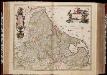
Novissima et accuratissima XVII provinciarum Germaniae Inferioris delineatio / A. Deur sculpsit
1 : 900000 Annotatie: Oorspr. verschenen in: Atlas contractus ... - Amstelaedami : ex officina Nicolai Visscher, [1656-1677]; Origineel is Blad 34 in atlas factice; Annotatie geografische gegevens: West boven Deur, Abraham [Amsterdam : ex officina Nicolai Visscher]
Niederlande u. Belgien
[Allgemeiner Atlas über alle Theile der Erde in 29 Blättern] Ziegler, Jakob Melchior Top. Anstalt v. J. Wurster u. Comp.
Germaniae Inferioris XVII provinciarum accuratissima tabula / nuperrime edita per Nicolaum Visscher
1 : 950000 Annotatie: Met privilege; Met opdracht aan Theodorus Munter; Annotatie geografische gegevens: West boven Visscher, Nicolaes (1649-1702) [Amsterdam : N. Visscher]
Holland and Belgium.
1 : 2080000 Tanner, Henry S.
Belgique, Hollande.
1 : 1000000 Lapie, M. (Pierre), 1779-1850
Niederlande und Belgien
Geographischer Atlas über alle Theile der Erde Ziegler, Jakob Melchior Verlag von Dietrich Reimer
Carte du Royaume des Pays-Bas, comprenant les routes de poste et relais depuis Paris jusqu'aux frontières septentrionales de la Hollande, avec un Itinéraire des communications de Strasbourg à Amsterdam et Hambourg
1 : 1280000 [par] Hocquart. Paris : Audin
Hollande, Belgique.
1 : 1070000 Andriveau-Goujon, J.

Die Niederlande und Belgien
1 : 830000 Belgie Kiepert, Heinrich Eulenstein, F. Geographisches Institut
Niederlande und Belgien
Neuer Handatlas über alle Theile der Erde Kiepert, Heinrich Verlag von Dietrich Reimer
Novissima et accuratissima XVII Provinciarum Germaniae Inferioris Delineatio. [Karte], in: Novus atlas absolutissimus, Bd. 3, S. 22.
1 Karte aus Atlas Janssonius Offizin
Belgique et Hollande
1 : 1300000 Thuillier, Louis; Hachette. Bibliothèque géographique. Firme Paris : Hachette et cie.
Holland And Belgium.
1 : 2100000 Tanner, Henry S.
Holland And Belgium.
1 : 2050000 Tanner, Henry S.
The Kingdom of the Netherlands
1 : 1495000 Belgie Walker, C. Baldwin & Gradock
![[Historisch-geographischer Atlas zu den allgemeinen Geschichtswerken von C. v. Rotteck, Pölitz u. Becker] : Die Niederlande zur Uebersicht der Hauptbegebenheiten](https://images-2.georeferencer.com/images/iiif/350308668576/full/,300/0/native.jpg)

