Maps of Germany
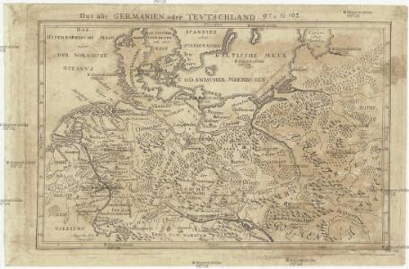
Das alte Germanien oder Tevtschland
Evropa střední
Allgemeine Postkarte von der Preussischen Monarchie zur Uebersicht. No. 36= Prospectus cursuum veredariorvm, qvi omnibus partibus monarchiæ Borussiæ reperiuntur

Tabula Europae IIII. [Karte], in: Geographia universalis vetus et nova complectens Claudii Ptolemaei Alexandrini enarrationis libros VIII, S. 231.
1 Karte aus Atlas Münster, Sebastian [und Ptolemaeus, Claudius]
Germania magna
1 : 2280000 Evropa severozápadní Reichard, Christian Gottlieb Campius, D. a D. Campio
Empire d'Allemagne, Hongrie, Gallicie, Prusse, Provinces-Unies de Pays-Bas en 1789.
1 : 3500000 Picquet, C.
Das neue politische Gesicht Mitteleuropas
1 : 2000000 Evropa střední Velhagen & Klafing
Das neue politische Gesicht Mitteleuropas
1 : 2000000 Evropa střední Velhagen & Klafing
Das neue politische Gesicht Mitteleuropas
1 : 2000000 Evropa střední Velhagen & Klafing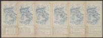
Tabula Europae IIII. [Karte], in: Claud. Ptolemaeus. Geographia lat. cum mappis [...], S. 263.
1 Karte aus Atlas Münster, Sebastian [und Ptolemaeus, Claudius]
Part of North of Europe.
1 : 3800000 Melish, John
Große Sprachenkarte von Mitteleuropa
1 : 2000000 Lange, Friedrich Reimer
Germaniae Antiquae
1 : 5100000 Mollova mapová sbírka Weigel, Christoph Weigel, Christoph I.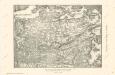
Die Ältesten Karten von Deutschland
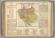
German Empire.
1 : 6200000 Lavoisne, M.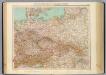
51-52. Germania, Polonia, Cecoslovacchia, Austria, Ungheria.
1 : 3000000 Touring club italiano
Übersichtskarte der Verbreitung der Deutschen in Europa
Evropa Kiepert, Heinrich Haas, František Dietrich Reimer
Germanie Ancienne.
1 : 5300000 Monin, C.V.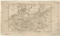
Das alte Germanien oder Tevtschland
Evropa střední Baumgarten, Siegmund Jakob Johann Justinus Gebauer
Sprachkarte von Deutschland
1 : 3000000 Evropa střední Bernhardt, Karl Bohné, J. J. von J.J. Bohné
[Ost-Europa in 6 Blättern, Blatt 3]
Handatlas über alle Theile der Erde und über das Weltgebäude Stieler, Adolf Justus Perthes
Prussia - Holland and the German States.
1 : 3380000 Sharpe, J.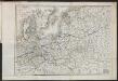
Carte du Théâtre de la Guerre en Russie et en Allemagne pendant 1812 et 1813
Russland, Deutschland, Befreiungskriege <1813-1815>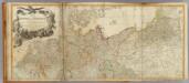
Germany (north)
1 : 1250000 Robert Laurie & James Whittle
[Ost-Europa, Blatt 3]
Adolf Stieler's Handatlas über alle Theile der Erde und über das Weltgebäude Stieler, Adolf Justus Perthes
Regenkarte, Mittlere Jahrestemperatur v. Deutschland.
1 : 7000000 Andree, Richard
Sprachenkarte, Religionskarte v. Deutschland.
1 : 7000000 Andree, Richard
Hohenschichtenkarte, Bevolkerungsdichtigkeit.
1 : 7000000 Andree, Richard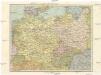
Střední Evropa
1 : 4500000 Evropa střední
Střední Evropa
1 : 4500000 Evropa střední