Maps of Germany

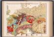
Germanie Ancienne.
1 : 5300000 Monin, C.V.
Germany.
from A system of geography, or, A new & accurate description of the earth in all its empires, kingdoms and states : illustrated with history and topography, and maps of every country : fairly engraven on copper, according to the latest discoveries and corrections / by Herman Moll.
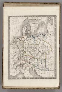
German Empire.
1 : 6200000 Lavoisne, M.
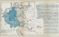
Empire d'Allemagne, Hongrie, Gallicie, Prusse, Provinces-Unies de Pays-Bas en 1789.
1 : 3500000 Picquet, C.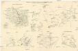
Skizzen zu den größeren Manövern der fremden Armeen 1906
Francie Streffleur, Valentin Ritter von L. W. Seidel & Sohn

Fluss- und Gebirgs-Karte von Mittel-Eüropa
1 : 4900000 Evropa střední Handtke, Friedrich C. Flemming
Composite Map: Map of the Central States of Europe Situate between France and Russia
1 : 1200000 Faden, William (1749-1836)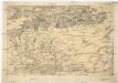
[Centralis Europae]
Evropa střední Schedel, Hartmann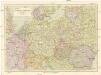
Střední Evropa
1 : 3000000 Evropa střední Kuchař, Karel Janka, Jaromír V. Neubert a synové
Map of the Empire of Germany.
1 : 1250000 Delarochette, Louis Stanislas d'Arcy
Neueste Karte vom Deutschen Reich der Oesterreichisch-Ungarischen Monarchie, der Schweiz, den Niederlanden, Belgien, Rumänien, nebst Theilen der angrenzenden Länder.mit besonderer Rücksicht auf Handel & Verkehrs-Interessen sowie zum Hand- und Comptoir-Gebrauch
mapa VKOL Baur, Carl Friedrich A. Hartleben's Verlag
Große Sprachenkarte von Mitteleuropa
1 : 2000000 Lange, Friedrich Reimer
Sbírka map a diagramů použitých na mírových konferencích v Paříži v letech 1919 - 1920

Übersichtskarte der Verbreitung der Deutschen in Europa
Evropa Kiepert, Heinrich Haas, František Dietrich Reimer
France, Switzerland, Germany.
Goodrich, S.G.
Das neue politische Gesicht Mitteleuropas
1 : 2000000 Evropa střední Velhagen & Klafing
Das neue politische Gesicht Mitteleuropas
1 : 2000000 Evropa střední Velhagen & Klafing
Das neue politische Gesicht Mitteleuropas
1 : 2000000 Evropa střední Velhagen & Klafing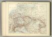
Carte Politique de L'Europe Centrale.
1 : 3600000 Jouvet et Cie.
Střední Evropa v době náboženské reformace a protireformace 1517 - 1648
Nr. 8a. Die Germanisierung des Ostens
Ostmitteleuropa Deutsche, Siedlung
Deutschland
Allgemeiner Atlas [Walch, Johannes] im Verlag bei Johannes Walch
Mittel-Europäische Staaten
Hand-Atlas über alle Theile der Erde nach dem neuesten Zustande und über das Weltgebäude Stieler, Adolf bei Justus Perthes
Die Ältesten Karten von Deutschland

Mitteleuropa während des 30 jährigen Krieges.
Evropa střední Benecke Bormann, E. F. Tempsky
Prussia, and the German States.
from New general atlas.
Rozsah moci význačných českých panovníků do XIV. stol.

Mitteleuropa am Ende des 30 jährigen Krieges
Evropa střední F. Tempsky