Maps of Germany

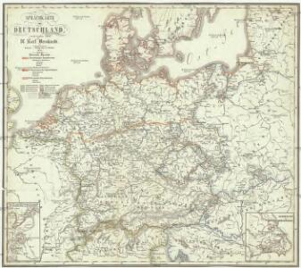
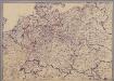
Sprachkarte von Deutschland
1 : 3000000 Evropa střední Bernhardt, Karl Bohné, J. J. von J.J. Bohné
Politisch-statistische Charte von Deutschland nebst dem grössten Theile von Pohlen, einem grossen Theile von Frankreich und Nord-Italien
1 : 2900000 Evropa střední Champion, J. N. Baumann, J. Mitzky & Comp.
German Empire.
1 : 2150000 Faden, William, 1750?-1836
German Empire.
1 : 2150000 Faden, William, 1750?-1836
Das neue politische Gesicht Mitteleuropas
1 : 2000000 Evropa střední Velhagen & Klafing
Das neue politische Gesicht Mitteleuropas
1 : 2000000 Evropa střední Velhagen & Klafing
Das neue politische Gesicht Mitteleuropas
1 : 2000000 Evropa střední Velhagen & Klafing
Tabula Europae IIII. [Karte], in: Geographia universalis vetus et nova complectens Claudii Ptolemaei Alexandrini enarrationis libros VIII, S. 231.
1 Karte aus Atlas Münster, Sebastian [und Ptolemaeus, Claudius]
Tabula Europae IIII. [Karte], in: Claud. Ptolemaeus. Geographia lat. cum mappis [...], S. 263.
1 Karte aus Atlas Münster, Sebastian [und Ptolemaeus, Claudius]
Regenkarte, Mittlere Jahrestemperatur v. Deutschland.
1 : 7000000 Andree, Richard
Sprachenkarte, Religionskarte v. Deutschland.
1 : 7000000 Andree, Richard
Hohenschichtenkarte, Bevolkerungsdichtigkeit.
1 : 7000000 Andree, Richard
Übersichtskarte der Verbreitung der Deutschen in Europa
Evropa Kiepert, Heinrich Haas, František Dietrich Reimer
Kriegszusammenhänge I (1618 - 1660)
1 : 12000000 Ostmitteleuropa Dreißigjähriger Krieg, Nordischer Krieg <1655-1660>
Composite: Germany.
1 : 1250000 Robert Laurie & James Whittle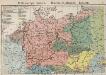
Mitteleuropa. Völker
1 : 9000000 Mitteleuropa Ethnische Gruppe
Deutsches Reich. Niederlande, Belgien & Schweiz
Adolf Stieler's Handatlas über alle Theile der Erde und über das Weltgebäude Stieler, Adolf Justus Perthes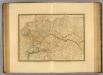
Empire d'Allemagne, Hongrie, Gallicie, Prusse, Provinces-Unies de Pays-Bas en 1789.
1 : 3500000 Picquet, C.
Post und Reise - Karte von Deutschland...

Map of the Empire of Germany.
1 : 1250000 Delarochette, Louis Stanislas d'Arcy
Deutschland mit der Kreis-Eintheilung von 1512
Evropa střední Benecke Bormann, E. F. Tempsky
A new map of the German Empire...

Prussia, and the German States.
from New general atlas.
Střední Evropa v době náboženské reformace a protireformace 1517 - 1648
[Mitteleuropa]
1 : 2500000 [S.l. : s.n.]
Téatre De La Guerre Des Couronnes du Nord. [Karte], in: Atlas nouveau, contenant toutes les parties du monde [...], Bd. 1, S. 67.
1 Karte aus Atlas Sanson, Nicolas Jaillot, Alexis Hubert und Mortier, Pieter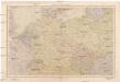
Střední Evropa
1 : 4500000 Evropa střední V. Neubert a synové
Karte des Deutschen Reichs
Schmidt, Johann Marius Friedrich; Jäck Schropp
France, Switzerland, Germany.
Goodrich, S.G.